Prove Every Route. Account for Every Crew. Defend Every Dollar.
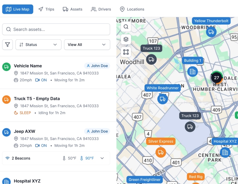
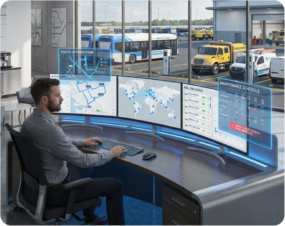
Track every excavator, loader, truck, and generator across every site. See what is running, what is sitting, what needs maintenance, and what has been moved without authorization. One view for mixed fleets, rough terrain, and real jobsite conditions.

Trusted by 3,000+ fleets across the globe


Key Challenges in Asset,
Trailer & Equipment Tracking
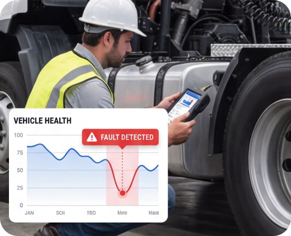
Preventive Maintenance & Vehicle Downtime
Vehicle breakdowns stop critical services. Reactive maintenance is expensive.

Scattered Data & Compliance Risk
Logs scattered across systems. Audit trails incomplete. Hours lost to manual work. Compliance risk exposure.

Budget Constraints & Limited Visibility
Limited budgets. No real-time visibility. Routes waste fuel and miles.”
Everything a Service Fleet
Needs to Operate and Account
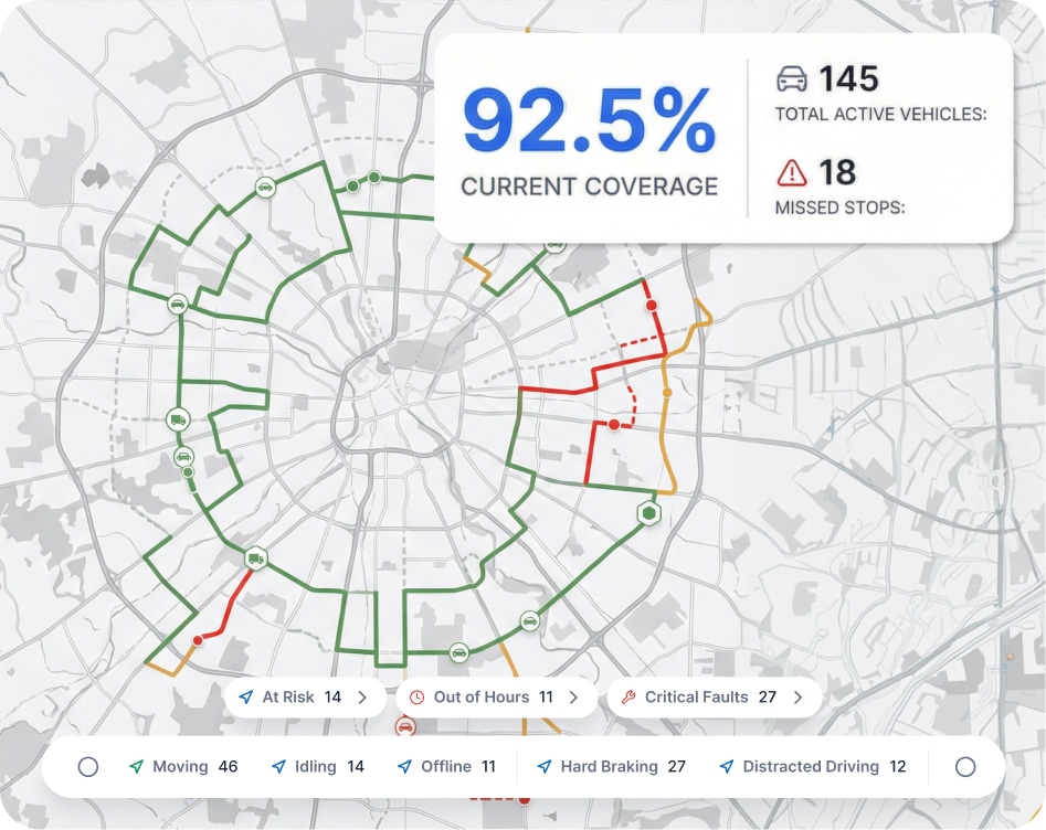
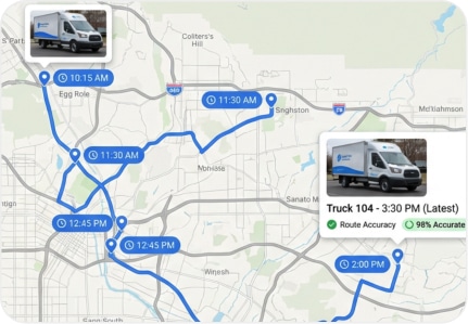
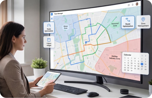
Route Tracking & Coverage Mapping
Real-time GPS tracking overlaid on planned routes. See completed coverage, missed areas, and route deviations as they happen. Export coverage maps for reporting.
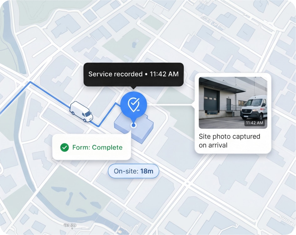
Proof-of-Service Documentation
Timestamped service markers, geotagged photos, digital forms, and time-on-site data captured automatically. Every service action is documented without crews filling out paperwork.
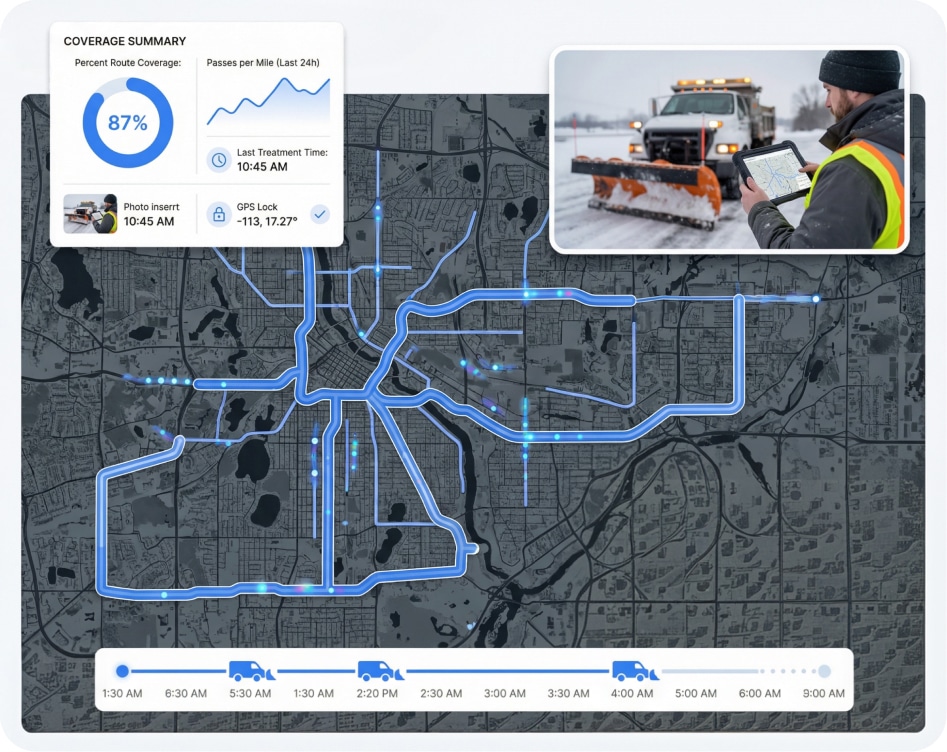
Winter Operations & Seasonal Readiness
Plow tracking, salt/material spread monitoring, and winter-route coverage verification. Prove every pass, document every treatment, and respond to complaints with evidence.
Crew Communication & Dispatch
Assign and reassign work from the office. Send route updates, priority changes, and exception alerts directly to crews. Reduce radio congestion and phone tag.

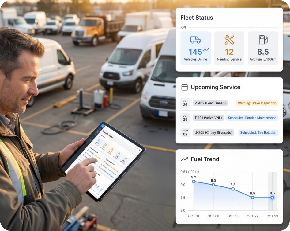
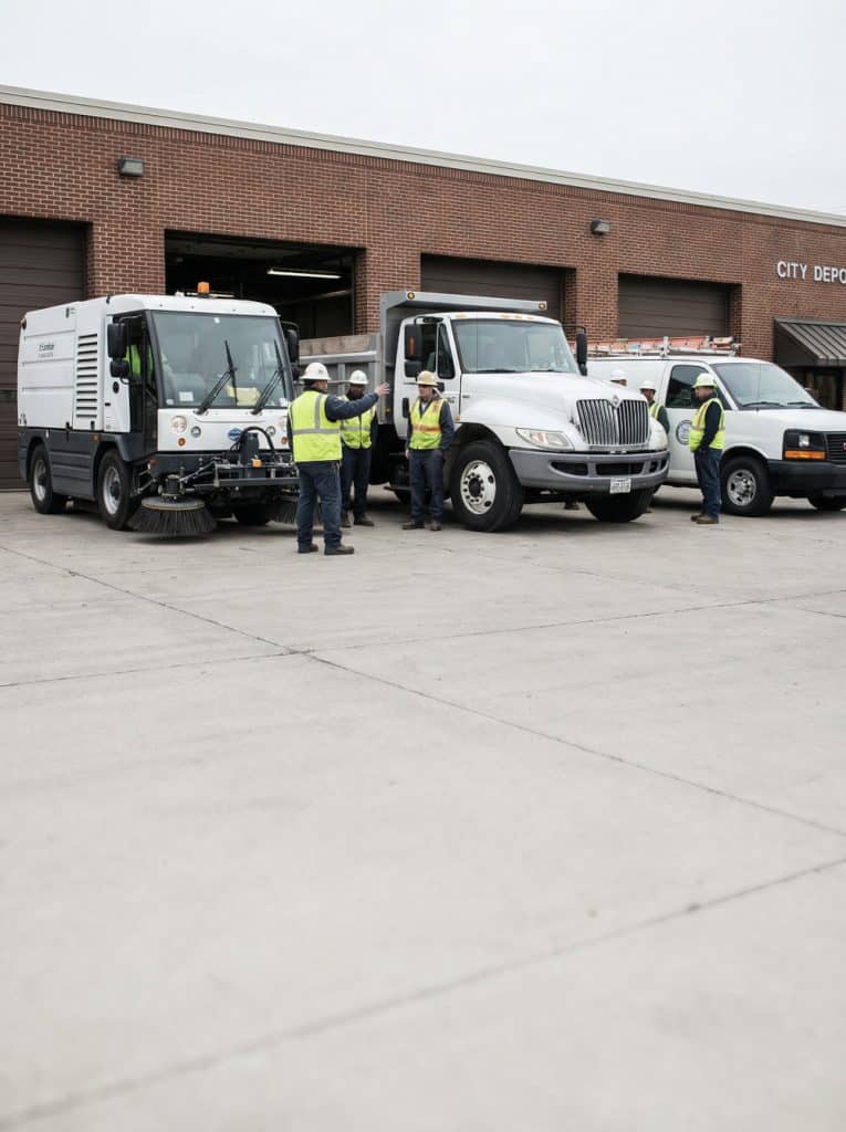
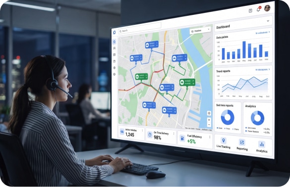
Vehicle & Equipment Monitoring
Track fuel consumption, engine diagnostics, maintenance schedules, and vehicle health across the fleet. Reduce breakdowns and keep service vehicles on the road.
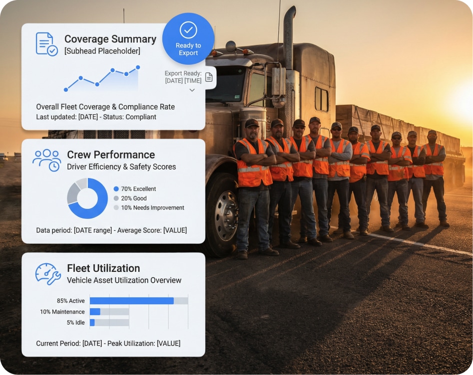
Reporting & Compliance
Automated reports for council meetings, budget reviews, audit requests, and operational performance. Exportable, time-stamped, and designed for public accountability.
What Changes When You Can See
Every Machine on Every Site
Timestamped evidence for every route, every crew, every action.
GPS-verified route coverage, service action markers, time-on-site data, and exportable reports that answer any question about what was done, when, and where.
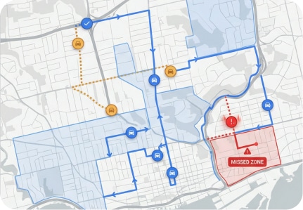
See what was completed, and what was missed, without making a phone call.
Real-time route progress tracking shows coverage as it happens. Missed zones surface immediately so supervisors can correct before the shift ends.
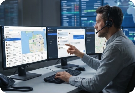
Send updates, reassign work, and adjust routes from the office.
Dispatchers and supervisors communicate directly with crews, adjust assignments, and respond to exceptions without relying on phone tag or radio traffic.

Data that supports your budget, not just your instinct.
Vehicle utilization, fuel consumption, route efficiency, and crew productivity reports give administrators the evidence to justify fleet spending and headcount.
Case Studies
94% reduction in unresolved service complaints within one year
When a council member asks if a street was serviced, we pull up the timestamped route with photos in 30 seconds. The conversation changed completely.
Les Anderson,Recovery Manager, Cascades Canada

$180K annual savings from optimized route coverage
A mid-size municipality eliminated redundant routes and reduced overtime by using real-time coverage tracking and crew reallocation.
Ronnie Camtrail,Chief Technician, City of Columbus
100% coverage documentation for winter operations
A county used plow tracking and material-spread data to respond to every citizen complaint with GPS-verified proof.
Dan Weiss,Chief Mechanic, Town Of Aurora
How It Works
Map Your Routes & Zones
We configure your service areas, route plans, seasonal overlays, and reporting structures, aligned to how your crews already work.
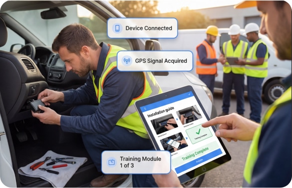
Deploy & Train
Devices are installed on service vehicles. Crews are trained on any field tools, digital forms, photo capture, status updates. Supervisors are onboarded to the live dashboard.
Operate & Report
Routes are tracked live. Service is documented automatically. Reports are generated for supervisors, administrators, and elected officials, without manual data entry.
Designed for public-sector procurement and implementation.
We understand RFP requirements, multi-department coordination, budget cycles, and the pace of public-sector technology adoption. Deployment is staged to fit your operation.
Devices Built for Jobsites, Not Office Parks
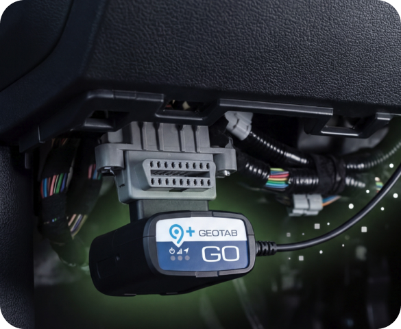
ELD / Vehicle Gateway (Geotab GO)
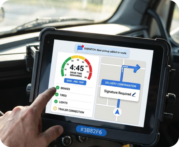
Driver Tablet / Mobile App

360° Dashcam Systems
FAQ
Can this handle multiple departments with different routes and schedules?
Yes. The system supports multi-department configurations with separate routes, schedules, zones, and reporting structures, all in one platform.
How does this integrate with our existing municipal systems?
We support integrations with common municipal fleet, asset, work order, and GIS systems. Open APIs are available for custom connections.
Is this compliant with government procurement requirements?
We regularly participate in government RFP processes and can provide documentation for compliance, data security, privacy, and accessibility requirements.
Can elected officials or administrators access reports directly?
Yes. Role-based access allows administrators and officials to view reports, coverage maps, and performance data without needing supervisor-level access to the full operational platform.
How do crews interact with the system in the field?
Crews use a simple mobile interface for status updates, digital forms, and photo capture. The system is designed for minimal disruption to field work.
Does this work for winter operations specifically?
Yes. Winter operations mode includes plow tracking, material-spread monitoring, route coverage verification, and complaint-response reporting.
Make Every Route Provable.
Make Every Dollar Defensible.
See how your operation looks when service is documented, crews are coordinated, and reports write themselves. Tailored to your department, your routes, and your accountability requirements.