Go Green With A GPS Fleet Management System

GPS Fleet Management Tracking Device Helps Businesses Go Green

Many businesses are feeling pressure to adopt “green” business practices and to reduce their carbon footprint. Some feel, however, that it is too big of a job to tackle and going “green” would not be worth the effort. In fact, having “green” fleet operations helps both businesses and the earth.

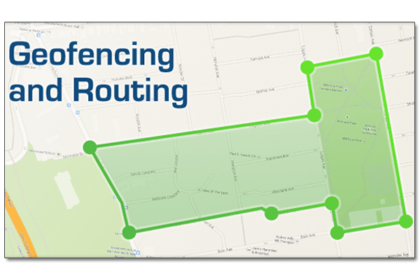
Reducing a business’ carbon footprint is easy with GPS fleet management. Fleet management software optimizes routes and dispatching to make the most efficient use of a fleet’s fuel consumption. Dispatchers are able to send the closest vehicles to job sites, reducing the amount of miles driven. Using fleet maintenance reports and alerts, businesses can ensure their vehicles are all efficiently operating. By controlling drivers speeding habits, excessive idling and aggressive driving, businesses can reduce their fleet’s emissions and the amount of fuel that is wasted.

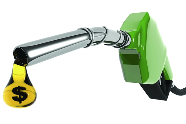
Go Green By Reducing Fuel Consumption

GPS fleet management provides efficient routing for the drivers. They will have the most direct route from one location to another. The faster and shorter the route, the higher a business’ productivity is and the less money that will have to be spent in fuel costs. In addition, reducing the amount of miles driven reduces greenhouse gas pollution. This translates into a significant amount of carbon reductions plus a savings of thousands of dollars per vehicle.


Go Green With GPS Fleet Management Maintenance Reports

GPS green fleet management software allows businesses to remotely monitor important fleet information such as engine fault codes, status of the emissions control system and motor oil life. Business owners or fleet managers are able to set up reminders that can be sent via email or SMS text message for vehicle tune-ups, tire rotation and oil changes. These service alerts can be used to immensely decrease fuel usage and help businesses to maintain a “green” fleet. According to the Department of Transportation, it is estimated that over 5 million gallons of fuel are wasted each day because of low tire pressure. Furthermore, the United States Environmental Protection Agency reports that an engine that is poorly tuned can produce 50% more emissions and use 50% more fuel than an engine that is properly tuned-up.


GPS fleet management helps businesses run efficient fleet operations, reduces operating costs and helps save our planet by reducing greenhouse emissions.

Route Planning Software: Reliable Fleet Management

Reliable Fleet Management With GoFleet’s Route Planning Software.

Managing fleet vehicles and drivers is next to impossible without using reliable real time GPS tracking with route management software. Luckily, GoFleet has a fleet management software integration that was developed to manage all parts of fleet management including vehicle maintenance, labor, driver management, routing and driver dispatching.

GoFleet’s route planning software integration is web-based and can be accessed using any computer or mobile devices with an internet connection. This convenient software makes real time fleet management easy for fleet managers in any location. They are not stuck working at the office where the route planning software is installed on a local computer.

Dynamic Route Planning

GoFleet’s route planning software simplifies and automates fleet routing and scheduling. Dispatchers have a real-time view of the fleet operations. Drivers can be provided with the fastest and most efficient route to job-sites. In addition, job scheduling and dispatching can be done quickly in response to real-time events. This is especially important in businesses that have narrow fulfillment windows or when late deliveries have high penalties. GoFleet’s route planning software can automatically re-plan routes in the event of traffic, breakdowns or emergency service orders.

Fleet Tracking

One major benefit of GPS fleet tracking and route planning software is that it allows fleet managers to see exactly where drivers are located and where they have previously been. All location information is easy to access on real-time live maps.

Reminders and Alerts for Vehicle Service and Management Issues

Fleet managers and business owners have the ability to set up reminders for vehicle service and alerts for management issues such as driver speeding, driving out of the authorized area and idling excessively.

Management Reports and Histories

When all fleet operation data is stored in the route planning software, it is simple to compile management reports and vehicle/driver histories that can help a business improve efficiency and reduce costs. Reports can be created for fuel usage, routes driven, driver’s habits and much more.

GoFleet’s route management software can enhance a business’ fleet operations by increasing productivity, improving customer service and reducing costs. Businesses will see their return on investment within a matter of months of implementing the system. For more information speak with one of our fleet consultants at 1-888-998-1122.

Fleet Management GPS Technology Increases Fuel Efficiency

Increase Fuel Efficiency With Fleet Management GPS Technology

The cost of operating and owning a vehicle in the U.S. has increased by approximately 2% in the past year, according to “Your Driving Costs” study by AAA. In addition, the cost of fuel has also increased by almost 2% a year since 2013, on top of the 15% increase in 2012. For businesses with fleet operations, these increased costs can significantly affect the company’s financial outlook. Eliminating excessive fuel costs by reducing fuel usage can considerably impact a business’ bottom line. Fleet management GPS technology can help business owners run their business more efficiently and reduce unnecessary fuel usage.

When a business implements fleet management GPS technology, they are able to eliminate excessive fuel usage using the fleet management software. When the vehicles are driven off-route, they are wasting fuel. With a fleet management solution, fleet managers and business owners will be able to make sure their drivers are where they are supposed to be and that they are driving the most efficient routes. Drivers will no longer be able to drive miles out of the way just to get a cappuccino from their favorite coffee shop. Drivers making a few off route personal stops can add up to hundreds of miles over a year.

Fleet management GPS technology also can be used to eliminate drivers’ bad habits including excessively idling for climate control. This will reduce fuel costs as well as reduce wear and tear on the vehicles. As a matter of fact, when a vehicle idles excessively, for 5 minutes or more, fuel consumption can increase by approximately 5%. This results in reduced profits and has the potential of damaging the vehicles’ engines.

Another factor in fuel wastage is driver speeding. When drivers are speeding, business owners and fleet managers can be alerted in real-time via SMS text message or email message. In addition to reducing fuel usage, managing drivers’ poor driving habits increases the safety of a business’ drivers and the safety of other drivers on the road.

An Overview of Geofencing and Routing in MyGeotab

Routing & Geofencing in MyGeotab GPS Fleet Management Software

A geofence is a virtual perimeter (or fence) around a geographical real-world area of interest. Geofencing allows users to draw virtual perimeters around places of work, gas stations, customers’ sites, homes, entire states, airports and more. It can also be a critical component for analyzing fleet behavior when combined with notifications and exception reporting. There are multiple benefits that can be gained through making use of geofencing, some of which include:

  • Increasing productivity
  • Establishing driver accountability
  • Tracking high value assets


Geofencing within MyGeotab
GPS Fleet Management Software


In the MyGeotab software, provided by Geotab and GoFleet, geofences are referred to as zones and the software provides easy-to-use tools for the user to create them. It is not necessary to be tech-savvy in order to understand how to create zones within MyGeotab. Also, you can create a large number of zones at once by importing a bulk list of latitude and longitude information prepared through a spreadsheet application, such as Microsoft Excel, or by defining the boundaries of the zone through the map.

routing mygeotab gps fleet management software

Example of creating a zone on the map within MyGeotab
One unique aspect of the MyGeotab GPS fleet management software is that it allows for zones to be combined with exception reporting. This results in the zone-based exceptions that are generated by drivers can provide information about which zones the drivers were close to throughout their work day and the duration spent around these set zones. This then allows for the following potential scenarios:

  • Send an email when drivers leave or arrive in a certain zone
  • Alert drivers who have left a certain zone early with an in-vehicle sound
  • When a delivery truck is about to arrive a notification sent to a shipping department
  • Notify managers if a driver has entered an unauthorized zone
  • Notify managers if a driver is spending too much time in a certain zone
  • Special cases of zone use with MyGeotab

Exception reporting in the MyGeotab GPS fleet management software is usually used to report when a vehicle is breaking a rule and may not typically be related to zones. The fact that MyGeotab has the ability to combine regular exception reporting with zones allows for some uniquely useful scenarios. Take a look at the following examples:

Example 1:
An oil and gas company located in Australia normally has to send their fleets to the outskirts of town to work on different projects. Most places these fleets need to go are off-roads and may not have speed limits. What this company has done with MyGeotab is create speed limit zones in these areas so that the fleet manager gets a notification if a driver is surpassing a certain speed. This allows fleet managers to create their own custom speed limits and to help ensure the safety of the drivers.

Example 2:
A taxi company located in Nova Scotia has combined the use of zones with auxiliaries. The company has attached auxiliaries to the taxi fare meters so that they are able to receive reports through MyGeotab whenever the fare meters are in use. In addition, the taxi company has placed different zones in the area where the taxi company operates. As a result, the company is able to receive reports on what areas their taxis are picking up customers and they are able to gain useful insight into where to allocate their taxis to get the most business.


Routing within MyGeotab


MyGeotab GPS fleet management software allows for the option to create routes based on zone locations. Some benefits that result from routing include increased organization operational efficiencies as well as reduced fuel consumption, mileage and CO2 emissions. Users can create a zone in the software by connecting a sequence of zones together to create a path. The routes can be defined in any order the user wishes, and can alternatively begin and end at the same zone. Further to this, MyGeotab software offers users the option to optimize the order of zones in which the driver should visit once the route has been created in an effort to minimize fuel consumption. Routing is especially useful for fleets consisting of school buses, for example, because these vehicles have predefined locations they visit everyday.

For a more detailed look at how to create zones within the MyGeotab GPS fleet management software, check out this video tutorial:
Creating & Adding New Zones in MyGeotab

For more information on how zones and routing could potentially increase the productivity of your business, contact a fleet consultant today.


Original Article Written by: Dominic Loong, Technical Support Engineer at Geotab
http://www.geotab.com/blog/overview-geofencing-routing-mygeotab/

GPS Capabilities In Anklet Helps Juvenile Court System

Anklet With GPS Capabilities Helps Juvenile Courts

As many people stop using landlines in their home, they are still a must-have for most people on house arrest. In Philadelphia, Pennsylvania, the juvenile system uses ankle bracelets that are really cell phones with GPS capabilities. Landlines are no longer necessary. It is a different story for non-violent offenders in the adult system, they still need this old telephone technology to serve house arrest. If the adults do not have a working landline at their home with no features including call waiting or DSL the do not qualify for house arrest.

These new house arrest devices with cell phone and GPS capabilities have other advantages also. For example, the young offenders can be monitored when they are approved to leave their house. The juvenile probation officers know where the juveniles are 24 hours a day – 7 days a week using the GPS capabilities of the ankle bracket. In addition, the juvenile probation officers can speak to the juvenile offenders via the GPS device with voice capabilities.

The ankle bracelet with GPS capabilities also has a software installed that can help solve crimes. If there is a high profile crime, shooting or any other crime in the area, the ankle bracelet with GPS capabilities can be used to put in a time and address from the crime to see if there were any youth that were in the area at the time of the crime.

In addition, the ankle bracelet with GPS capabilities has a locator that is an alarm that sounds like a police siren. If a juvenile offender violates the terms of his or her release, the siren will help authorities locate the offender if they are trying to hide. This is helpful if the offender is hiding in a large crowd or even in a home. The siren is so loud, the probation officers will have a much easier time locating a house-arrest violator.

GPS Monitoring Devices To Be Worn By Violent Offenders

Mother Pushes For Law To Require Violent Offenders to Wear GPS Monitoring Devices

Five years ago, a restraining order did not prevent Randall Todd Moore from sexually assaulting, kidnapping and shooting his wife who was separated from him, Terese Ann Lynch Moore. Now Terese’s mother, Sheila Lynch, is pushing for new law in Iowa. This law would require offenders ordered by a court to stay away from their victim to wear a GPS monitoring device. The electronic GPS monitoring device would alert the victim and local law enforcement if the offender got close.

Approximately 19 states currently have similar laws for violent offenders. Domestic violence is a real problem that needs a solution that works. In Iowa, Lynch argues, there is no solution. She believes if a law like this existed in Iowa and Randall Todd Moore was required to wear a GPS monitoring device, her daughter might still be alive.

Sheila Lynch states that it is hard for most people to understand how an offender can get to their victims. She said that her daughter stayed with her husband through years of abuse. Terese Ann was deployed to Iraq three times as a staff sergeant for the National Guard. When she met her husband, her demeanor and personality started to change. Previously a spunky woman, Terese became uncertain about herself and quiet.

Terese Ann Lynch was only 30 when her husband killed her. She would often urge people, including her mother, not to visit. Her mother noted that she felt like her daughter was sacrificing herself so her husband did not hurt anyone else.

After Terese Ann finally got a restraining order for her husband, he went to her apartment and kidnapped her. She had no idea that he was approaching her home. He sexually assaulted her and then fatally shot her in the face with a shotgun. When Moore was sentenced, he showed no remorse for what he did. He received three back-to-back life sentences. He also received 25 years for attempting to murder a Des Moines, Iowa police officer. If Moore had been wearing a GPS monitoring device, local officials and her daughter would have known he was approaching Terese’s apartment. Sheila Lynch wants a law on the books in Iowa requiring GPS monitoring device to be worn by offenders to help save other victims.

Global Positioning System Used To Monitor Vanishing Water

Vanishing Water Monitored With Global Positioning System

For years, small movements in the Earth’s crust have been monitored, using the Global Positioning System, to help provide warning of developing earthquakes. Researchers were surprised to discover that the GPS is also recording data in relation to the vanishing water in the western United States. Throughout the region, the landscape has been drying out massively due to the intense drought over the past year

Geophysicists from the Scripps Institution of Oceanography reported in Science Magazine that the GPS measurements indicate the loss of water from streams, lakes, groundwater, and snowpack total approximately 240 billion metric tons. This is the equivalent to 4 inches of water covering the western United States from the Pacific to the Rockies

The water loss measurement principle is simple. The weight of the Earth’s groundwater and surface water deforms Earth’s crust similar to the way a person’s weight deforms a mattress. When the water is removed, the Earth’s crust rebounds. The water levels on Earth vary with the seasons causing the Earth’s crust to move up and down. The movement is only fractions of an inch; however, the Global Positioning System is able to measure these small shifts

Since early 2013, researchers noticed that there has been a tremendous uplift signal (rise) in the Earth’s crust. The current uplift pattern is consistent with the declines in precipitation, groundwater levels and stream flow. Without the water, the Earth’s crust is elastically rebounding over the entire region

The Global Positioning System data complements observations from NASA’s satellites. NASA has an ongoing experiment, GRACE (Gravity Recovery and Climate Experiment), which is measuring small changes in the gravity field on Earth caused by water movement under and on the Earth’s surface. This experiment allows researchers to estimate soil moisture and groundwater conditions all over the world. The GRACE experiment is able to operate in areas around the world where Global Positioning Systems do not exist yet, such as South America and Africa

The new Global Positioning System data may prove vital as the climate changes worsen. This finding makes GPS data is useful to a wider group of scientists and researchers.

Vehicle Tracking System: Construction Company Fleets

Increase Profit In The Construction Industry With A Vehicle Tracking System

In order to have a successful construction company, you must run your business efficiently and show up at job sites on time. You rely on your construction fleet to make that happen. With GoFleet’s vehicle tracking system, you can stay ahead of your competition with valuable fleet management tools that will help you improve customer service, reduce costs, optimize your fleet’s productivity and ultimately increase your bottom line.

Reduce Labor Costs:

When you use GoFleet’s vehicle tracking system, you can improve dispatching and routing for your construction workers. By providing efficient routing, your workers will arrive at job sites earlier and spend less time on the road. In addition, you will know where your workers are at all times. You will not have to worry about a worker making authorized stops while they are on the clock. This improved productivity will reduce expensive overtime and labor costs.

Lower Fuel Consumption:

GoFleet’s vehicle tracking system provides your fleet managers with the tools they need to lower fuel consumption. For most companies with fleet operations, fuel costs are the single most expensive costs relating to the fleet. This cost can be reduced because fleet managers are able to monitor driving speeds, aggressive driving behavior and idle times, all of which increase fuel consumption.

Improve Customer Service:

When you use GoFleet’s vehicle tracking system in your construction fleet, you can drastically improve your customer service. Your customers will be astonished when your construction company actually shows up at the scheduled time. If a driver happens to be late, you will be able to let your customer know an accurate time of arrival. They will not be stuck waiting around for your construction workers to show up on the job site. Furthermore, your customers will be happy with the fast response time. With a vehicle tracking system, you are able to send the closest workers to your customers’ locations.

Vehicle GPS Tracking System: Government Businesses

Government Businesses Benefit From Implementing a Vehicle GPS Tracking System

Government fleet managers have to deal with government mandates on fleet utilization and size, budget cuts and aggressive goals to reduce emissions. A vehicle GPS tracking system helps government businesses meet these challenges by optimizing your fleet size, decreasing operational costs, reducing emissions, deterring vehicle theft and helping you achieve your fleet management goals.

Vehicle GPS tracking systems will provide your government business with the data you need to fully understand your fleet’s performance and the tools you need to improve it.

Reduce Labor Costs

Improved routing and dispatching minimizes the time your drivers are on the road, improves response times and helps you to prevent expensive overtime. Most government businesses see a reduction in labor costs only months after implementing GoFleet’s vehicle GPS tracking system.

Decreased Fuel Consumption

Monitoring your drivers’ speed, aggressive driving habits and idle time can be used to decrease your fuel consumption and costs. This is often the largest expense for a government fleet.

Optimize Fleet Performance And Size

When you are able to completely analyze your fleet’s performance including miles driven, days utilized, peak usage and average usage, you will be able to optimize your fleet’s performance. There are many customizable features that let you track each vehicle by location, site or department. This information will allow you to make the most informed business decisions regarding vehicle utilization and fleet size.

Deter Vehicle Theft And Any Unauthorized Use

When you use GoFleet’s vehicle GPS tracking system, you will not only deter theft, you will eliminate unauthorized usage of government vehicles. If your drivers drive off-route or use the vehicle during personal time, your fleet manager will be immediately notified. Drivers will no longer be wasting time and fuel driving off-route to get a bite to eat or a cup of coffee. This will improve your customer response times and reduce labor and fuel costs.

For more information about how GoFleet’s vehicle GPS tracking system can help your government business, Contact Us.

GPS Used To Enhance Experience At Cuyahoga Valley National Park

Cuyahoga Valley National Park Uses GPS To Enhance Experience

According to Cleveland.com, Cuyahoga Valley National Park will soon use GPS to provide a virtual park ranger on visitors’ smartphones. Researchers at Kent State University have received a National Science Foundation grant in the amount of $952,000. This grant is to be used to create a free mobile application for the park with many interactive features including information about the park’s history, geology, scientific park features, and habitat.

Park visitors will be able to log in anonymously and provide valuable information to the park scientists and rangers to help them learn more about Cuyahoga Valley National Park’s ecosystem. They will also be able to save specific information about their park experiences. Visitors will be able to easily interact with the park staff from the convenience of their mobile device. The park staff will also be able to see the visitor’s exact location via GPS in the event they need help.

There are other mobile applications with information about the national and local parks; however, none of them have nearly as much detail as the proposed application. It is more of an augmented reality then a virtual tour. It provides many tools that will enhance the visitors’ experience. The prototype should be ready within 6 months and the application should be fully functioning within a year. The application could eventually be used by parks around the world after they build the databases of content.

As part of this project, funding will also be provided to Cuyahoga Valley National Park for 2 seasonal employees that will help implement and test the new mobile application using GPS data. The users will be surveyed to find out what they learned, their interests and their attitude on personal learning. There are over 2.5 million people who visit the Cuyahoga Valley National Park each year. The visitors make approximately 11,000 requests for information about park resources and wildlife. The new app should reduce the number of requests because visitors will have all the information at their fingertips.