zendumaps, gofleet, gis, mapping, winter maintenance, waste management, city works

6 Industries that can benefit from ZenduMaps

By now, you’re familiar with the ZenduIT mapping software system that we offer ZenduMaps, which offers real-time location-based operations management that benefits fleets across a number of industries. The use of telematics is becoming increasingly prevalent among fleets, and managers of all kinds are beginning to understand the benefits of tracking vehicle location, driver behavior, work planning and so much more.


While the more obvious applications for ZenduMaps might include winter maintenance and seasonal road work (read more about the advantages of ZenduMaps for public works here), there are a number of operations that could benefit from this powerful fleet management tool. 


City Planning


Geographic Information Systems (GIS) have been very successful tools for urban and rural planning over the last several years. Whether the task is planning for new roads, working out local taxes or planning the next desirable neighborhood, the data gathered from ZenduMaps can help develop a new city, track its expansion and plan the direction of future growth.


Using GIS data, cities can manage planning, analysis and reporting — all factors that are necessary for successful building. With this secure, cloud-based software, stakeholders across local government and private organizations can be engaged to ensure that zoning, city bounds, street names and more are accurately and efficiently mapped. The platform provides geospatial data sets that deliver more effective solutions for planning management and city operations. 


Waste Management


The ZenduMaps platform has integrated tools to help improve productivity and reduce costs, both of which address common challenges within public works, but can be applied specifically to waste management. The public sector has a unique set of needs; waste collectors have the double task of clearing garbage quickly, efficiently and on a regular cadence, while appeasing constituents . 

ZenduMaps can manage and optimize waste collection vehicles, increase productivity and encourage fleet managers to adhere to waste collection schedules. The routing function increases fleet visibility and efficiency, while optimizing pickup schedules and litter control. Moreover, scheduled pickups and routes are searchable and viewable by the public, which fosters goodwill and keeps citizens informed.


Government


Government contracts represent some of the biggest use cases for ZenduMaps, as well as some of the greatest accountabilities. In this instance, GIS data can track all vehicles, assets and routes on a live map, allowing you to receive alerts based on predetermined triggers. The platform can also produce maintenance schedules and reports to reduce fuel costs and maintain vehicles before a problem arises.


The mapping of service locations and routes offers real-time feedback on completion rates and allows government agencies to proactively detect missed services or insufficient resources before they become a problem. 


To help manage public perception, the public can gain visibility into historical reporting and analytics for service verification, including work location with date and time stamps. By benchmarking the capacity of staff and equipment, an agency can verify the need for additional resources, or reallocate existing resources to other projects.  


Transportation


GIS data is commonly used for managing existing transportation issues while allowing those agencies to plan ahead for new roads and routes. The ZenduMaps solution offers fleet managers full visibility into the operational data of all government vehicles on a single platform, and provides the tools to effectively reduce costs, maintain compliance and ensure road safety.


Water Utility


One of the most critical areas for geospatial technology is water asset management. Mapping solutions provide water utilities with improved asset management capabilities. Creating smart, connected networks with water utilities can ensure clean drinking water for a community, a city, or the global population. In this case, agencies can accurately and efficiently maintain the utility’s infrastructure to help meet the increasing demand for water.


In addition to tracking water pressure and monitoring potential leaks, GIS mapping technology plays a vital role in digitizing water networks, and can help provide valuable insights into locations and assets, including pipes and reservoirs. Data gathering, both historical and current, can help water utilities plan new infrastructure projects and provide a complete picture of the utility’s performance. Water managers can use this technology to improve service levels and ultimately improve customer satisfaction. 


Agriculture


Pursuant to the development of water utility infrastructure in cities, GIS data also holds sway in rural areas where water is essential to the agricultural industry. The availability of water directly affects crop production in a given region; GIS mapping can produce efficient techniques for farming, identifying crops and determining yield. GIS data can also help analyze soil data, which increases food production.


The goal of a mapping platform is to reduce costs while improving efficiency, operational effectiveness and quality of service. Speak with one of our consultants about implementing a solution for your industry. Contact us now for your free trial!

cityworks, mapping, zenduit, zendumaps, gofleet, government, fleet

A Beginners Guide To Cityworks And Its Benefits

In the latest integration of systems that improve workflow and increase transparency among its stakeholders, ZenduIT has merged processes with Cityworks technology to create a veritable mapping superpower, aimed at engaging not only city workers, but regular citizens as well. By leveraging geographical information systems (GIS), Cityworks uses data to connect previously siloed city systems and ultimately build safer, smarter and more resilient communities.


What is Cityworks?


A geographic information system creates, analyzes, maps and manages all kinds of data; it connects data to a map, integrating “where things are” with descriptive information, such as “what things are like there”. It helps us understand patterns, relationships and the context within a geographical location. GIS creates fertile ground for mapping and analysis that can be used in virtually every industry, improving communication, efficiency, management and optimal decision making. 


Cityworks helps you fully use your GIS data and improve operational efficiency. This leading web-based GIS asset management system tracks, manages, scores and analyzes the assets that comprise your infrastructure. Designed to help city-run agencies streamline their workflows, track data and improve communication, Cityworks helps local governments and utility agencies get work done.


Scheduling work activities


Cityworks provides a detailed foundation of asset management. Cityworks allows you to combine assets based on key factors such as age, type and location. These groups can be used to create and schedule various maintenance activities.


Mapping Tools


Because Cityworks is built exclusively on GIS, you can easily map open service requests, or work orders of varying types. These tools empower and encourage you and your staff to use asset data and create an integral part of the work management process.


Mobile Data


We live and work in a mobile-centric environment. Your data should be portable as well. Cityworks has a number of tools to help your crew access and update valuable content on site and on the go.


Work Orders


You can track work that has been performed on an asset at any time throughout its entire lifecycle with Cityworks. Users can search for work orders and view them on the GIS map. Track active or overdue work orders and monitor work, regardless of whether it’s associated with a specific project, contractor or task.


Improve Communication


Once you can track asset data and work history, you can better share this information with staff, cross-functional departments, and public citizens. Cityworks users have created solutions to improve communications across a number of tasks, including repairs, inspections, emergencies, permits and resident requests or inquiries. 


How Cityworks can benefit your city


Fostering goodwill


Often, information silos and archaic systems prevent a city’s infrastructure from working efficiently. ZenduIT works synergistically with Cityworks to improve communication between a city and its constituents. Imagine having a work management tool that creates digital public maps where citizens can report issues in real-time. 


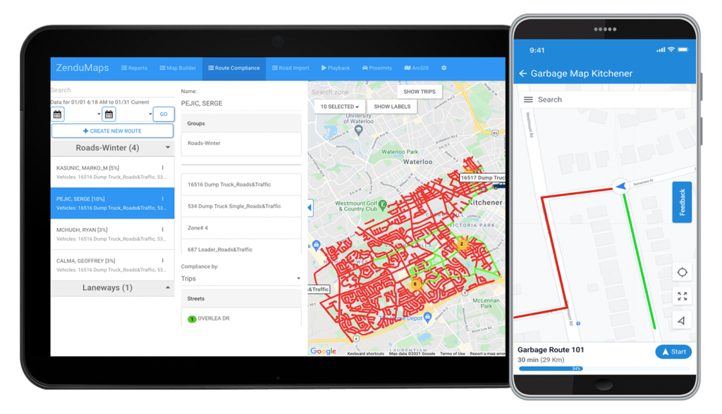
ZenduIT’s mapping interface, ZenduMaps, allows the public to do exactly that. No more long, laborious 3-1-1 calls. Whether there’s a spotted pothole or burst pipe, users can simply click on the digital map and feed that data to the proper department. When they’re shared, intelligent monitoring tools foster goodwill between a city’s inhabitants and the infrastructure that’s there to support them.


Automated processes and applications


Connecting technology offers better tools to communicate with the residents within a city. For example, Cityworks can streamline the process of tracking property stabilization by making data and inspection status easily accessible and transparent across departments. This system of record keeps both residents and city employees in the loop and fosters efficient workflows.


Similarly, ZenduMaps can create a public map, whereby residents can report issues or render complaints in real-time, either on the site or using their mobile devices. Issues are submitted to the proper city department, and the tool can now allocate work to the proper crew, or feed into a third party work order management system such as Cityworks. Consider the applications for not only road work, but waste management and winter maintenance. Most cities currently operate under a “search and fix” process, but with strong citizen engagement and specific GIS data, the continuous course of mapping and fixing can create proactive, predictive patterns for future work, patrolling and route optimization.


Cityworks and ZenduMaps work together to drive public engagement; that component of citizen involvement helps create a dynamic and transparent workflow, where everything from reporting issues to taxes can be managed interchangeably, with input from the people who are most impacted.


Work management tools save time and generate efficiencies. When they’re connected, these same tools can also create goodwill within a community and improve some of the city processes currently in place. Together with ZenduMaps, Cityworks will help you build safe, resilient and smarter communities.

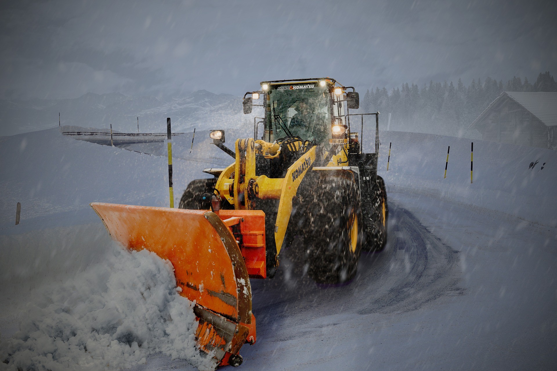
winter operation programs, winter, snow plow, gps, telematics, winter operation departments

What’s On The Horizon For Winter Operation Departments

As the weather begins to get colder and with many cities around the world already seeing snow, it’s time for winter operation programs to kick their initiatives into full gear. For many departments this includes performing comprehensive research on how they can improve their efforts. 

Sound familiar? Keep reading as we will discuss the various factors that winter maintenance fleets must stay on top of and how new technology is critical in their success. 


How Some Winter Operation Departments Are Falling Behind 

Depending on several factors including budget, need or even manpower, some winter operation fleets fall behind in terms of leveraging smart technologies. What this means is that many fleets may not be utilizing new strategies, initiatives or technologies. As a result, certain operational efficiencies are automatically lost causing a decrease of productivity, optimization, and visibility.

What should winter operation programs look out for to know whether this is happening to them? 

First, they should look at the operations of their competitors or the industry as a whole. This is a critical first step to easily see whether you’re behind in certain areas. Fleets should look out for the following: 

  • How other municipalities or fleets can share mapping information publicly on a visible and modern map solution 
  • How other teams are maintaining workflow and reporting easily and efficiently 
  • Productivity or costs that are quickly diminishing 

Next, teams should research best practices online and see what the conversations surrounding new initiatives are. 


Things That Every Fleet Needs To Know About 

Things are constantly changing – it’s evident. However, it’s important to know what GoFleet, an industry leader in 360 fleet solutions, has observed and thinks is important for fleets to know about.


Smarter Software Than Just GPS 

Certain software solutions are already widely used. Often this incorporates basic GPS tracking solutions to ensure the location and route of a vehicle is known. This allows on a basic level, for teams to monitor compliance and route completion. 

Where things get innovative, is when software is leveraged to utilize this GPS data to monitor more data. Pushing data into software with algorithms that leverage GPS information visually is how the data can be displayed publicly. Often this is via an embedded code on a website that automatically pulls real-time information that the fleet pre-categorizes to be available to the public. By doing this, it allows winter operations departments to be transparent so civilian drivers can better plan routes and ensure that safe roads will be used for travel. 

Additionally, this map data can be manipulated to show compliance on an internal level. Efforts can be reviewed for efficiency and steps can be taken so roads are cleared in adequate times. Reports can also be created to prove that compliance is met at all times. How is this possible? Geofencing – a tool which divides map locations into zones to section off tasks or designate tasks and routes. 

To summarize, connected software solutions allows for the following to be completed within winter operation fleets:

  • Vehicle optimization and fuel usage reports to ensure efficiency  
  • Fleet compliance to regulations in regards to snow clearing 
  • Driver behaviour reports to ensure safe driving is monitored 
  • Resource utilization reports to monitor quantity and location span of where resources are used – this can include fuel, salt and even sand 
  • Geofencing to track progress, next routes and restrictions 


Connected Hardware Options

Hardware may seem obvious, it’s not that simple. There’s more to hardware in winter department fleets than one may think. By leveraging connected hardware solutions and sensors to track pre-existing hardware, even more intel can be collected on fleets – this is a necessity for winter departments reviewing current operations. 

By leveraging connected hardware, more data can be collected. Meaning the above points related to software solutions can in fact be accurate so proper actions can be executed. Not only does this include GPS tracking such as the GO9 device, but also a dash camera system, driver ID system and much more. Integrating these products and connecting them internally allows for the following: 

  • The GO9 monitors HOS compliance, GPS location, engine performance and more
  • Dash cameras can monitor and record not only driving events or accidents, but whether the driver is attentive to the road ahead
  • Driver ID systems ensuring that the right driver is operating the proper vehicle and the timing of shiftwork 

For aspects of the vehicle that don’t allow for an initial connected piece of equipment like plows, salt or sand dispensers, sensors can be leveraged. Installing smart sensors to track various vehicle actions or tasks ensures complete visibility. In regards to winter department vehicles, sensors monitor when plow equipment is used – proper tracking of route and work commencement can happen as the sensor will detect when the plow is truly in operation (being down or up). As well, sensors can display a proper picture of resource utilization throughout a route and whether certain locations were over or under served. This ensures resources are not wasted to keep costs low. 


Have All Of This In Place? This Is What Is On The Horizon… 

If you’re one of the winter department operations who have all of this in place, it’s still important to stay up to date with future trends. This will ensure that your team is prepared with new tools and strategies in upcoming seasons. The following is predicted to be introduced: 

  • Intelligent camera technologies will use artificial intelligence (AI) and machine learning to improve data collection from equipment via smart city networks 
  • The environment will become a larger focus as electric snow plow vehicles are leveraged to reduce carbon emissions and lower operational costs 
  • Vehicle-to-vehicle and vehicle-to-infrastructure communication will evolve on a 5G network that will provide fast lines of communication 
  • Operations can be automated as autonomous vehicles are introduced to eliminate human error and costs 

While much of the information stated above is directly related to winter operation departments, the same technology and thinking will be seen in other industries. If you’re interested in learning more about how your fleet, regardless of the industry, can improve or better prepare for future technical challenges, contact us today.