Telematics in dangerous sectors

How Telematics Comes Into Play In Dangerous Sectors

In any industry, workplace safety is of critical importance. Industries where contract workers are hired by authoritative management corporations to complete tasks in dangerous sectors, often find themselves looking at how they can improve safety measures.

As many tasks in these fields require the use of heavy machinery or the movement of large and hazardous items – many are looking at how telematics advancements can help.


Hiring In Dangerous Sectors

To fully understand the need to implement safety measures via telematics, the hiring process must be understood in dangerous sectors such as construction, transportation, forestry or logging and even mining and oil. In these industries, businesses often outsource work by hiring contractors rather than hire full or part-time workers. There are number of reasons why:


Productivity and Finances 

Often in these dangerous sectors, this type of work is seasonal. This means that workers are only required at certain times of the year. Corporations prefer the flexibility of outsourcing work, so they do not have to deal with the administrative challenges of constantly having to layoff workers at the end of each busy season.

Corporations understand the massive financial benefits of outsourcing to contractors. Operations managers discovered that by hiring seasonally, they can perform cost comparisons in terms of productivity and pay for all workers.

They are able to perform such comparisons during the season to monitor and re-hire the best-performing contractors. As a result, corporations can maximize their productivity and revenues, allowing them to remain competitive in an aggressive marketplace.


Reduced Liability  

By outsourcing work and hiring seasonal contractors, many corporations also find that they can improve their liability risk. This enables their business to be more focused on supplying the proper safety requirements, while the actual need to carry out safe work practices are shifted to a  constructor or general contractor who undertakes ownership of the project.

It is important to highlight that corporations will be required to ensure safety in the means of: (i) ensuring proper training is available; (ii) all workers and supervisors are properly trained on safety policies or precautions; (iii) have the appropriate safety tools; or (iv) the proper equipment and safety environment to protect the workers.

This means that the constructor is responsible for ensuring that all workers on site are complying with safety policies, procedures and obligations – or inadvertent liability.


Risk Evaluation and Assessment: Onsite and Offsite 

In sectors where authoritative management governs worksites, the concern of safety does not end there. There are risks when workers are moving supplies or travelling between sites. When risk is evident in numerous locations at varying times, the need to collect and analyze data to evaluate risk becomes even more critical. 


Onsite Risk

Onsite risks are typically limited to the immediate actions of contractors. Often this refers to the knowledge of training and precautionary measures taken by workers while completing tasks. For example, knowing how to safely harvest timber and load lumber into the flatbed of a truck with the use of heavy machinery. When proper training and undamaged tools or equipment is utilized, the onsite risk is significantly lowered.


Offsite Risk

In comparison, offsite risks are factored-in to the immediate actions of contractors – as well as their working environment. As much as offsite risks arise when goods are being transported, contractors must be attentive to their surroundings. A wide range of unpredictable incidents can happen at any job site – including injury, road clean up and even lost resources.

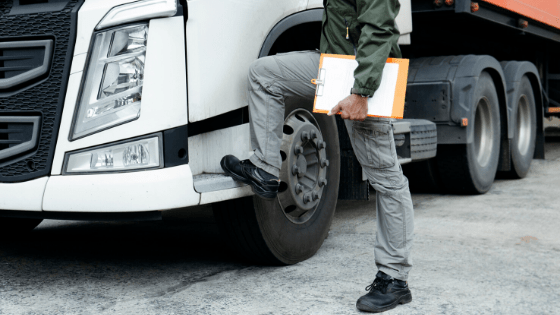
A business can mitigate the risks by having pre-trip checks on the vehicle or implementing tools to ensure that strict safety protocols are being followed.


How Authoritative Management Can Reduce Risks

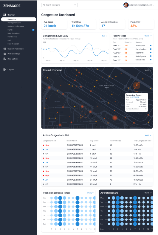
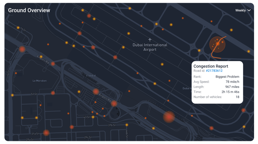
To properly reduce risk and liability concerns, fleets in these dangerous sectors must investigate risks and assess danger in the field. To better understand current initiatives and procedures, companies must evaluate key historical safety indicators – which will shed light on how efforts may need to change.   

In order to fully understand your current KPIs and solutions framework, a telematics assessment should be performed. It’s important to note that while solutions may have several advantages, it is critical to understand how the solution will specifically target safety.

There are three options that can be implemented in industries that are dangerous or hazardous for its workers.


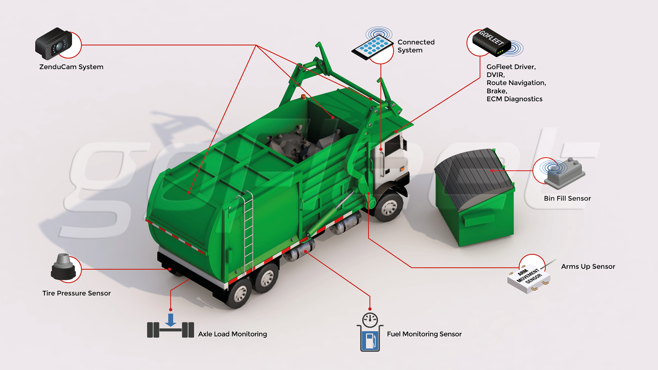
1 Sensorizing Your Fleet 

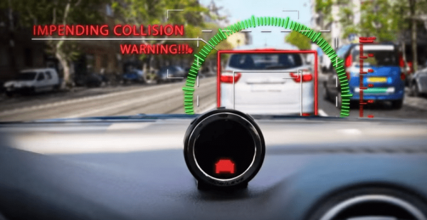
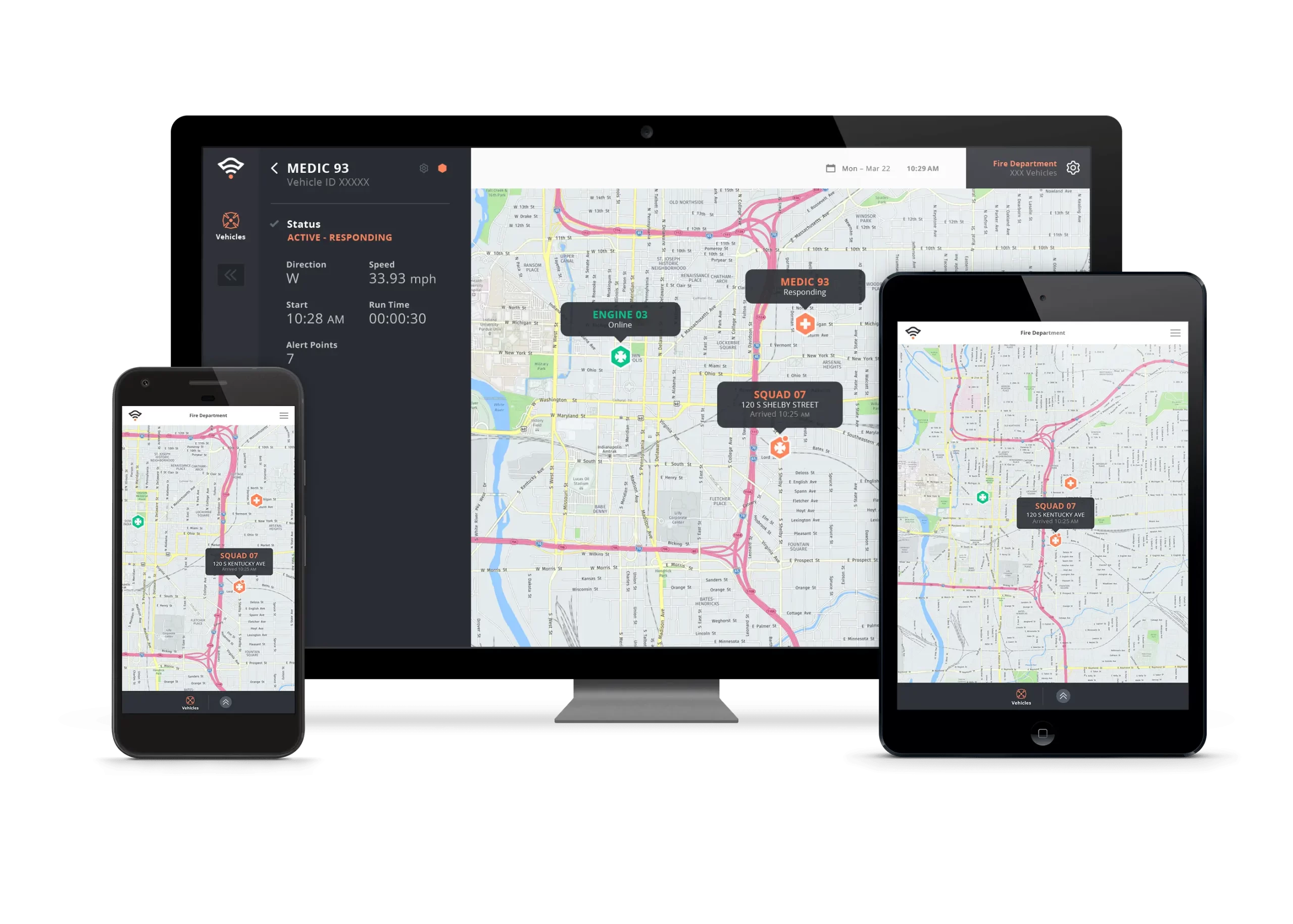
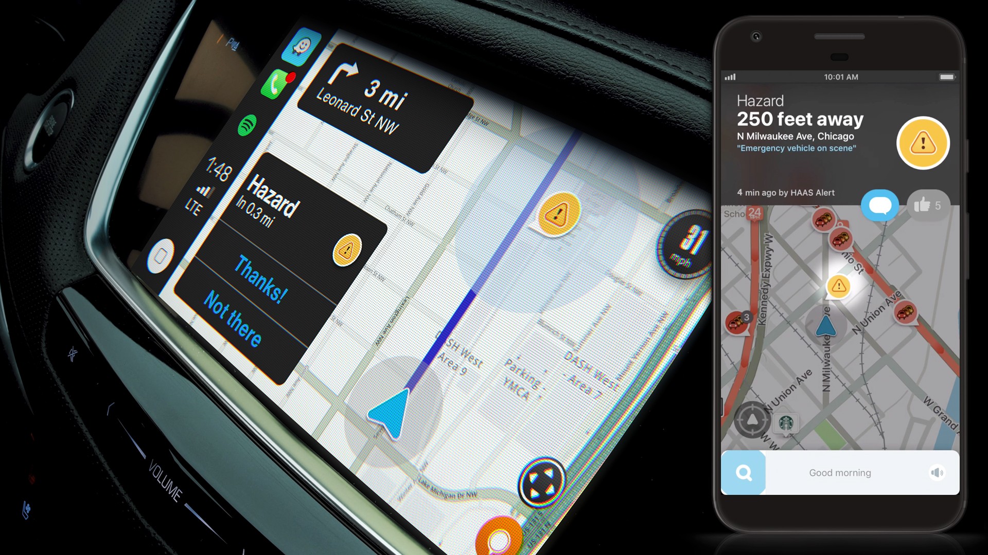
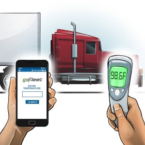
Installing sensors throughout your fleet can minimize risk as the devices can act as a safety precaution. Since the technology transmits various data internally, many corporations have found sensors to be useful for the following: displaying real-time GPS location, displaying alerts or notifications and confirming weight or load requirements.

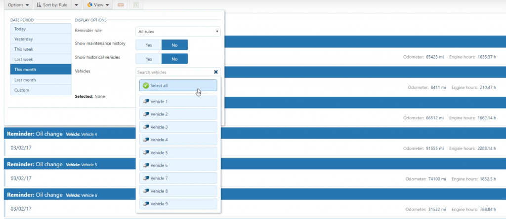
When sensors are installed onto equipment or vehicles, teams can know the exact movement of the asset it is attached to, in addition to certain compliance requirements that may need to be met – such as weight or load. However, one important use to highlight is the alert system for trip inspections, as the sensor can convey whether certain safety precautions are faulty. This means that unsecure lids or caps, loose straps, completed walk around checks or even whether a contractor has the proper training on file to use certain equipment can be detected. 


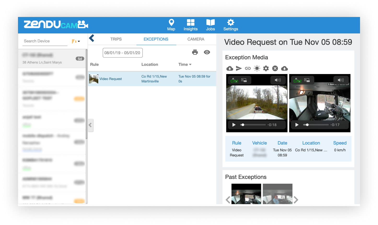
2 Increased Visibility With Cameras 

Cameras can be installed throughout fleets to monitor the use and performance of vehicles and heavy equipment. Not only can this record the events in view of the device, such as general employee safety on site, but it detects whether contractors are using the equipment properly while moving between two points.

The most important feature of using the cameras, however, is to perform incident reviews when there is an accident, reported issue or complaint of delay. By having footage readily available, site managers are able to review what happened rather than rely on worker or civilian recollection. Meaning proper actions like additional training, suspension, or understanding of liability and fault can happen. 


3 Safety Scoring And Training Integrations 

As previously mentioned, cameras can be used to help shed light on more training opportunities. Specifically, equipment use via engine monitoring and camera surveillance can be used to determine safety scores for each worker. This allows for performance ratings to be completed and even allows for training or site suspension to be assigned based on the person’s skills or knowledge of procedures.


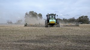
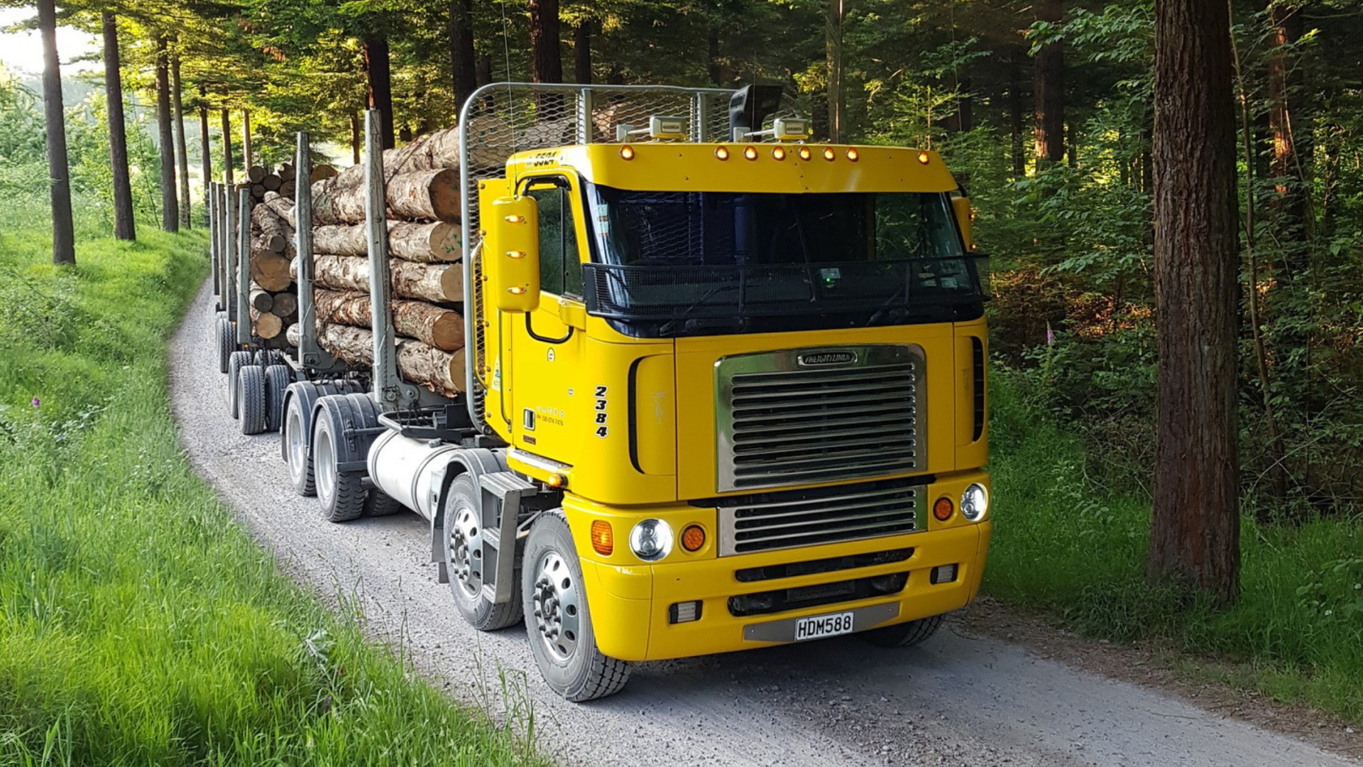
Use Case: Forestry and Logging 

To ensure safety in a high-risk sector like forestry, many authoritative corporations are implementing telematics solutions throughout their operations. Such telematics solutions include the three previously discussed tools: sensors, cameras and scoring or training systems. 

By sensorizing fleets, corporations in logging are able to ensure that certain actions are always taken and even set up alerts to notify workers when certain actions were not taken. This is specific to the loading process on a logging site when lumber is placed on flatbed trucks to move it to the millsite. Since these vehicles are moving thousands of pounds of lumber, if straps are not secure, cargo can find its way off the vehicle while on route. If this happens, regardless of whether it is on public or private roadways, death and injury of a bystander becomes a real concern. 

Fleets that install cameras on vehicles and heavy machinery find that they can better monitor the behaviour of employees – focusing on whether individuals are acting safely by following procedures. This enables companies to flag safety concerns. Such concerns include insecure loads being dispatched or contractors forgoing pre-trip checks. 

Cameras are also useful when offsite vehicles can sometimes be involved in accidents involving civilians, such as accidents with other vehicles or dangerous driving. Verifying what really transpired by reviewing the driver footage can shed light as to what truly happened and who was at fault. It can also provide a resolution framework as incidents are documented and structural changes are made to rectify them

Lastly, all of the information collected on employee behaviour can be reviewed and submitted into a scoring system. Meaning managers can see who is following safety protocols and who may need additional training.

To learn more about how telematics is being used right now, check out our recent success story that features Forest Trotter by clicking here.


Dangerous Driving

Why Now Is The Time For Your Businesses To Embrace Vision Zero

Vision Zero is a bold move that intended to eliminate traffic-related fatalities and severe injuries and improve the safety of streets for users of all transport modes through a data-driven smart approach. Municipalities and cities across the world have accepted the challenge of working towards this ambitious target. The government took the initiative of improving road safety to protect motorists and pedestrians, with business and private fleet managers being adhering to strict safety protocols.

Poor management and supervision could result in drivers committing dangerous driving behaviours. This jeopardizes everyone’s safety on the roads and increases businesses’ risks to spend unnecessary costs to resolve incidents. As a result, companies and fleet managers face increasing stress and pressure on improving fleet safety and enforcing fleet safety policies. By using the right telematics products and tools, businesses can help build a sound fleet safety system, reduce operating costs, and foster a positive safety culture within the companies. 


Why You Should Get on Board With The Idea Of Vision Zero?

In 2018, Canada recorded 1,922 motor vehicle fatalities and 9,494 serious injuries. Vision Zero declares the idea of “no loss of life is acceptable” on our streets and roads. Companies bare huge financial risks if one of their vehicles get involved in traffic accidents, especially when a fatality or severe injury occurs. 

Hefty fines, monetary compensations, insurance bills, and vehicle maintenance bills drastically undercut the bottom line and effect operational and financial stability of businesses. To mitigate financial losses resulting from road incidents, a small investment in telematics solutions could help bolster businesses in the long term from multiple fronts. 

Establishing good and trackable fleet safety records not only prepares businesses for possible safety inspections, it ensures they meet regulatory compliance. By having good safety records, businesses are in a better position to win future customers and gain valuable industry partners. Demonstrating clear and well-organized fleet safety records to prospective customers strengthen a companies’ case that is highly reliable and pays attention-to-detail. This is especially crucial in transporting high-value, fragile, time-sensitive, or temperature-controlled shipments.

The Vision Zero initiative put a much-needed focus on using data to identify safety risks and power solutions. In preparing your businesses for the future, a smart data-driven cloud database is a must-have to manage all your fleet data, historical trips, and safety information. 

A cloud database has the capability of storing all vehicle movement data, recording footage, and maintenance history – which can be easily assessed and reviewed from anywhere. Adopting cloud-based technology and data management system eliminates the need to spend extra costs managing multiple different transportation and asset management systems. 

The completed and integrated data management solutions also remove the hassle of printing paperwork and finding physical space to store all the paperwork. From a broader perspective, the data-driven approach contributes to constructing an open-data platform that supports the Smart City initiative. Without any additional work, the data collected from your fleet activities help shape a safer community for all without compromising your data safety and privacy. Telematics solutions and technologies are the only possible way to power all these activities with minimal resources required.


How To Make Easy Commitment To Telematics Safety Products?

Since the start of the COVID-19 pandemic, many industries have taken a huge hit both in operations and finance perspectives. Businesses and companies are becoming more vigilant and careful in monitoring companies’ expenditures. Businesses and fleet managers may hold doubts as to whether it’s necessary to invest in telematics safety solutions. 

There are concerns about whether there are enough improvements to justify investing in telematics. Rest assured that we know and understand your concerns deeply, and we have an incredibly talented and knowledgeable team that will help you find out which solutions suit your fleet the best. 

Our personalized consulting service will help you identify the safety risks hidden in your fleet operations, create an individualized plan to mitigate risks, offer diverse financing options, and provide you full support in device installation, training, maintenance, and customer support stages. 

We know the best way for you to fully understand our products and solutions is to give you the opportunities to see them for yourself. That’s why you have the chance to test our devices and solution within a small size of your fleet. We offer a variety of tools to help you monitor, measure, and quantify performance and improvement. From there, you can fully evaluate the products and make informed and data-driven decisions that suit your business needs. 

The government is offering a variety of financial incentives, funding and subsidies programs to promote Vision Zero. They are committed to giving confidence and assurances in making smart decisions for everyone in our community. 


Monitoring Your Fleet

We do not only offer one product but offer an integrated safety solution package that can be customized to your liking and needs. Many roadway incidents were caused by vehicles’ skidding and hydroplaning which had low tire pressure. 

Advanced tire pressure sensors provide accurate, reliable real-time monitoring of tire pressures and temperatures. It will send drivers and fleet managers visual and audible alerts if the system detects dangerously low-pressure situations. 

The system is well-integrated with the Geotab platform and other GoFleet products to provide an integrated fleet management solution to businesses. With full visibility to tire health, auto-generated long-term tire performance reports, maintenance reminders and warnings, the system will help reduce maintenance costs, extend tire life and, most importantly, protect your drivers and other road users. 


Eliminating Distracted Driving And Driver Fatigue

In Ontario, deaths from collisions caused by distracted driving have doubled since 2000. Distracted driving will not only put everyone in danger but also costs your business money and reputation. Many business owners and fleet managers faced the difficulties of tracking and monitoring drivers’ driving behaviours during their shifts. 

The driver distraction camera serves as a perfect solution to protect your fleet from distracted driving. It features facial recognition technology that can detect when the drivers are distracted or if they are tired. An audible alarm will sound to alert drivers and trigger video recording, so fleet managers can always check back footages later to educate and improve the driver’s training program. Being an effective tool in combating distracted driving and driver fatigue, the driver distraction camera is easy and quick to install and implement, which means businesses can instantly see a noticeable fleet safety improvement. 


Protecting Drivers and Your Assets From Collision 

Even the most well-trained drivers could sometimes make mistakes in daily driving, and that’s why it’s necessary to invest in technologies that can make a big difference at the most critical moment. Mobileye is an integrated advanced collision avoidance system that can protect drivers if a threat is detected. The system will provide a visual and audible warning seconds prior to the collision. Providing drivers with more reaction time can dramatically reduce crashes and improve fleet safety record. The device uses sensing technology to recognize vehicles, pedestrians, and cyclists around the vehicles, and it’s often called the driver’s “third eye.” 

Forward Collision Warnings

The lane detection system warns drivers when they are drifting out of their lane or getting too close to nearby vehicles. Most impressively, the system works on any occasion, both day and night, and even during the fierce winter in Canada. After installation, customers will expect to see a significant improvement in driver’s driving behaviours and safety culture in the fleet. Businesses will see a decrease in collisions and accidents, which saves businesses from paying hefty fines, compensations, and insurance premiums. 


Encouraging Safe Driving Habits

In addition to providing immediate safety protection to the drivers, focusing on the long-term safety improvement within the fleet is equally essential. ZenScore is an interactive driver scoring system that puts quantifying measurement on driver’s performance and driving behaviours. It records unsafe driving habits performed by drivers and assigns a score to each driver. 

Fleet managers could use the results to incentivize drivers with good driving habits and coach high-risk drivers with additional training. Through rewarding drivers with good driving habits, businesses can encourage other drivers to follow good driving habits and improve employees’ morale. An overall positive safety culture within the fleet could help your workers stay safe, improve fuel usage efficiency, and reduce vehicle idling time. 

Businesses can’t afford to overlook safety as any fleet safety incidents could cause serious disruption to business operations and weaken businesses’ financial situations. Safety should always be the top priority, regardless of fleet size and industries. 

If you are looking for a little guidance or help on improving your fleet safety records and heading to the Vision Zero target, contact us today! With our industry-leading solutions and knowledgeable expert team, we are confident in taking your business to a safer and smarter future!

Operational Congestion at airport

Part II: The Solution To Operational Congestion – A Congestion Management Strategy

In Part I, we discussed how operational congestion is very costly and a major source of problems for businesses. If it is not addressed, it will starkly impact operation managers from a financial and productivity standpoint, and result in customer dissatisfaction.

In Part II, we will discuss how highly localized environments like airports must use a solutions-based management strategy to prevent congestion and work pauses/stoppages.


Why Data Collection Will Allow For A Better Understanding Of Operations

In order to solve the issue of congestion in any localized environment, it is critical for factors into what is causing the congestion to be broken down. After highlighting these factors, a complete review of the assets within the localized area must happen to better understand the need and intensity of the demand. A specific spotlight must be put on the time and dates of movement and the severity of the resulting congestion. When this is completed, only then can insight to what triggers congestion can be understood and addressed with a solution.


Airport Resource Management – Data Collection and Airport Congestion

When dealing with airport resource management and congestion, this framework can be easily applied. The factors that cause the congestion can be analyzed – focusing on when runway traffic happens, what assets are involved, what the travelling speed of the assets are and what the posted speed of the roads are, as well as the intensity of the congestion. 

Generally, it is found that when more flights are landing or departing, more assets are required to service the aircrafts. This results in a buildup of congestion and only recedes once servicing assets are in detention.

Once this information is known and is cross analyzed with the speed of the roads, mapping can be completed to show the correlation of the average speed – what time slow downs are happening – and understand where major congestion points are.

What can operation managers do with this information? The answer is to source and implement a proper congestion management strategy. 


Implementing A Congestion Management Strategy

When information regarding what assets are causing congestion or when slowdowns happen, a congestion management strategy can then be implemented. By leveraging a heat map, businesses can effectively display asset types, the average speed traveled, the time of day travel, and the calendar date traveled. This new stream of information can guide a new and more effective strategy. 

A best practice to minimize the impact of congestion during high-demand traffic is to strategically divert traffic through travel routes. This will result in less congestion as there are fewer assets who require the road. Oftentimes, this means using detour routes so they will not be required to travel through the same routes. This may require certain assets to be directed to take specific detour routes – either permanently or during traffic spikes. Although it may seem counter-intuitive for assets to be taking the “longer route,” these detour routes drastically reduce congestion and ensure that assets continue moving. 

To ensure success, policies and procedures must be enforced by the airport resource management strategy so employee behaviour changes during this strategic shift. Leveraging learning systems, like ZenduLearn, can help with this change, as staff are assigned new training modules that explain the new driving routes and the new congestion-reducing regulations. 

In fact, the GPS tracking solutions can be paired with the learning system to see whether drivers are following the new regulations and alert operations managers when a route infraction occurs. 


Reducing Congestion In Any Industry

Congestion happens in many industries. Whether it is distribution warehouses, construction sites or airports, not being able to locate or track the movement of assets can affect the bottom line of a business. 

Contact us today to learn more about how your business can benefit from a unique congestion management strategy and the solutions we recommend to help you see results.

Operational congestion occurs in highly localized environments such as airports

Part I: More People Are Affected By Operational Congestion Than You Think

The backlog of stationary assets can result in operational delays, lengthy completion of tasks and will add additional costs to projects. If we focus on the costs of congestion, one thing becomes clear – the ongoing costs are too much to bear for businesses. 

Below we discuss how congestion in business operations, where environments are highly localized, must be addressed to reduce operational losses. As well how this affects airport resource management. 


Where Congestion Is Not Yet Understood

When the general public thinks of congestion, they think of the travel delays between two points during high-demand times or peak hours. However, it is important to emphasis that congestion happens way more than you think and is not limited to the roads during rush hour.

Operational congestion occurs in highly localized environments such as airports and warehouse distribution hubs. These environments often have few routes available for transportation and there is limited data collected about the movement of assets. With few route options and limited data – congestion is bound to occur.

While some delays are inevitable in these environments, allowing it to continue for too long is too costly for businesses to ignore. If businesses focus on the costs of grid locking and backlogs, they will find that many resources are wasted as staff are unable to maintain a steady workflow. Such delays cause a ripple effect and can adversely affect customer relations – as customers become frustrated standing in long waiting lines.

In comparison, non-localized environments (what much of the public encounters when travelling on highways or city streets) have data sources available to help alleviate congestion. Sources like Google Maps has been implemented to collect, display and analyze congestion information on an ongoing basis and in real-time to the masses. 

In fact, this flow and analysis of information has inspired operation managers to be specific in how and where they want to reduce operational congestion in localized environments. 


Congestion In Airports

With thousands of assets moving daily – highly localized environments like airport grounds are a prime example of where congestion can be found. With constantly moving assets, airport operations have a goal to optimize flow of traffic, reduce gridlock and lower wait times of assets in detention. 

To properly stop asset detention, an entire framework of what congestion is in an airport environment must be understood by equipping assets with various telematics solutions. By using connected sensors to see how equipment is being used, as well as GPS tracking to note the location and speed of vehicles – businesses can gain proper visibility into operations. Doing so will allow for assets to remain in movement, shortening servicing turnaround time and as a result, increase revenue.


The Repercussions of Congestion In Airports And Airport Resource Management

Airports cannot afford to allow congestion to be ongoing. Not only does it cause for asset detention or the pause of asset movement, but it results in a myriad of issues: 

  • Overall fleet performance will drop as work is at a standstill 
  • Some operations are at risk for being charged for the waits
  • Heavy financial losses are experienced as employees are paid even if work cannot be performed – causing a potential spike in higher ticket prices
  • Resources are wasted when equipment or vehicles are idling 
  • Passengers suffer lengthy delays when travelling 
  • Attention to detail and safety decreases as staff rush to complete tasks to stay on time  

It’s important to note that these repercussions of operational congestion may seem specific to airports, but very similar issues can be noticed in other highly localized environments. Distribution hubs, for example, are seen to encounter very similar productivity, financial and consumer effects. 


Triggers of Congestion

Airports are highly localized as there are few roads that thousands of assets must utilize at predetermined speeds. Since there can be numerous assets such as refuelers, tugs and tractors, water trucks, passenger boarding steps and more servicing, each aircraft – from the second it lands to moments before it takes off – can contribute to congestion. 

The problem of congestion is compounded when aircrafts take off and land every few minutes – meaning that they must undergo routine aircraft maintenance by servicing crews. This causes longer than necessary turnaround times, especially during high-traffic and peak times. 

Part II: The Solution To Operational Congestion – A Congestion Management Strategy

Waste Disposal Fleets

The Responsibilities Of Waste Disposal Fleets That Can’t Be Overlooked

Waste removal fleets are under constant pressure. If they miss a day in their schedule, the fleet could face setbacks and flak for days after. To help reduce adverse outcomes, having 360 telematics solutions to minimize physical, business and environmental risks. 


A 360 Solution In Action For Waste Disposal Fleets

We’ll discuss the top three responsibilities that waste removal fleets have from the moment they are deployed. We’ll also see how 360 solutions that leverage GPS tracking via engine monitoring, sensors, online learning platforms, and smart camera systems can be used to help ensure that a waste disposal fleet is always meeting their responsibilities. 

waste disposal, waste management, telematics, technology


A Fleet’s Responsibility To The Environment: GPS Tracking And Sensors

Waste disposal fleets have a responsibility to reduce their environmental impact. In 1999, the Canadian Environmental Protection Act was put forward to prevent acts that lead to pollution and harm to the environment. Specifically, the act focuses on businesses and organizations remaining sustainable by reducing emissions and stopping improper disposal of waste. After this act was in place, waste management fleets felt the need to use telematics to reduce their fleet operation’s environmental footprint. Fleets used this new focus on the environment as an encouragement to implement GPS tracking and sensors to not only make routing more efficient but improve driver behaviour. 

For many private or business-based waste disposal companies, GPS tracking solutions proves useful when optimizing the routes driven based on the fill levels of waste bins. Doing this helps to ensure that businesses do not produce extra and unnecessary emissions. This is made possible by installing bin fill sensors on waste bins to monitor the content fill level. After installation, when the sensor detects a fill level over 80%, the bin is automatically placed on a route so it can be emptied. Time and resources are no longer wasted on emptying bins that aren’t full yet. Likewise, using bin fill sensors can significantly reduce litter resulting from overfilled bins. These sensors are often used in waste disposal bins in public places like parks or residential areas where it may be hard to visually monitor when a bin needs to be emptied.

For public or residential waste pickup services, GPS tracking solutions can also help correct bad driving behaviour. Need a clearer picture? Government vehicles can idle for up to 4 hours a day to result in up to 27 million gallons of excess fuel each year. By using a GPS tracking and engine monitoring system in a vehicle, the device can monitor the engine activity. The device can alert the driver when the vehicle is idling to correct their errors and stop unnecessary fuel wastage. When a solution like this is in place, idling can be reduced by up to 20% to lower greenhouse gas emissions and even help the fleet save fuel by reducing consumption. 


A Fleet’s Responsibility To Conducting Proper Driver Training: Smart Camera Systems 

Another responsibility that waste disposal fleets have addressed with telematics solutions is driver training. Specifically the implementation of dash and full-vehicle camera systems to monitor driver behaviour – or the responsibility to properly conduct driver training to maintain safety on roadways.

When used alone, camera solutions can monitor how well drivers absorb training. This applies to new hires who must absorb new material and veteran drivers who may develop bad driving habits over time. However, it should be noted that the main way that camera solutions have evolved is through the learning process. Specifically how previous footage of driving incidents can be used in future training material to teach drivers how to maneuver unique situations. 

Currently, camera systems are being used by fleets for safety training by visually showing drivers how to approach unique situations. For example, when pedestrians or cars are blocking curbside bins, videos of drivers properly encountering this in the past can be shown—essentially allowing previous drivers who are operating safely to be used as an example to fellow drivers.

For training, camera solutions work best when paired with an online training platform like ZenduLearn. ZenduLearn allows for managers to assign and track the training of all drivers easily. This ensures that they receive refresher courses on basic driving skills and that drivers receive specific training regarding the types of waste they are transporting or unique scenarios they may encounter. Depending on the nature of a waste removal fleet, a solution like this may become essential to quickly and efficiently educate new team members. 

ZenduLearn Train certificate


A Fleet’s Responsibility To Remain Accountable: Smart Camera System And Sensors

The third responsibility that waste disposal fleets have on the road is the responsibility of remaining accountable to driving events or incidents. Specifically driver accountability. While we previously discussed some aspects of maintaining accountability with camera solutions and training, this thought continues when fleets use the camera footage for driving incident reconstruction. A good example is reviewing footage to manage complaints or concerns, so appropriate actions such as additional training or driver suspension can happen.

When camera solutions are installed, the devices are able to capture everything that is happening within its view. Cameras on waste disposal fleets have a view of the driver, the front, sides, and rear of the vehicle. When these areas are recorded, any complaints about drivers on mobile devices or reckless driving can be later reviewed. In fact, these cameras help drivers protect themselves from false complaints from residents. Specifically, residential complaints of unemptied curbside waste bins that were blocked by a vehicle (making it unsafe to approach and service) as the driver can take a snapshot of the unsafe scenario.

In addition to helping fleets better service bins and maintain efficiency on routes, sensors can help fleets remain accountable. When sensors are placed on moving vehicle parts such as arms or packer panels, teams can know precisely when movable parts of the vehicle are in motion. So if there is a complaint about arms moving and causing damage to buildings, or packer panel doors not opening in time to cause garbage to become litter, the occurrence will be recorded.

When waste disposal teams take advantage of 360 telematics solutions, they are able to improve their service. When it comes to a fleet’s responsibility to the environment, training or remaining accountable, there is no room for shortcuts or errors. If you’re interested to learn more about a 360 solution that is unique to your business needs, contact us today to speak to one of our consultants. 

food transportation, cold chain custody, telematics, temperature monitoring

Food Transportation: Why Temperature Monitoring Should Not Be Overlooked

Given the current economic environment, many commercial transportation fleets can’t afford to have hiccups in their operations. When speaking about food transportation, this remains true as food products are at a higher risk of being rejected by receivers if they do not meet strict temperature requirements. As a result, more stress has been placed on enforcing food safety regulations and using the right telematics tools to reduce cargo losses of temperature-sensitive goods. 

Financial Implications of Temperature Sensitive Products 

Food transporters are at risk financially if they are unable to abide by strict temperature storage guidelines. In the past, when loads are found to not meet strict transporting guidelines, receivers may deem the products within the load unsafe and refuse to accept them. Meaning, if even one shipment in a 36-foot trailer gets transported at an improper temperature, businesses can lose up to $30,000

In an attempt to mitigate financial losses resulting from the improper transportation of temperature-sensitive goods, telematics technology is steadily gaining popularity.


Why Shipments Get Rejected

Regardless of how far a delivery is, transporters with subpar temperature monitoring systems may not meet specific temperature qualifications. When this happens, receivers may decide to reject the shipment, as previously mentioned. For example, if frozen goods are on the brink of thawing when they arrive, or if heat-sensitive dairy products are delivered warm, receivers could refuse to accept the load. Consumers are at risk of bacterial poisoning if these products are allowed to reach the store shelves.


Regulations to Ensure Safe Food Transportation 

To reduce the likelihood of spoiled products being sold to the public, in 2017, the FDA introduced the Food Safety Modernization Act (FSMA). The focus of the FSMA was to create a strict, standardized playbook. The regulations would prevent improperly documented and unsafe transportation of human and animal food products regardless of whether the products were in open or closed containers. 


According to the FSMA, individuals in food transportation must ensure the following: 

FSMA Deadling Approaching

  1. Vehicle trailers transporting food products must be pre-cooled to specific temperatures by shippers prior to the goods being loaded;
  2.  Cold-chain integrity must be maintained during the entire trip, and transporters must explain any temperature breaches along the way;
  3. For at least one year, shippers and transporters must record the last three shipments of trailers for each delivery.

With these rules in mind, it’s important to note that the FSMA did not mandate the use of telematics. However, it is easy to understand why telematics would make meeting compliance easier and more precise.


Initial Compliance Concerns 

When the Food Safety Modernization Act was introduced, many found that their fleets were at risk for not meeting requirements. This is because their drivers were relying on outdated and inaccurate temperature monitoring tools. Such systems typically only provided drivers with basic information about trailer temperatures as they did not use advanced telematics technology to see what the actual ambient air temperatures are. Older systems would only show temperature readings on in-cab displays of the blower output air temperature. These readings can be misleading as the device does not take into consideration the conveyor effect of cold and warm air variations caused by opened and closed doors. 

Temperature monitoring by samsara


What Consultants Recommend For Food Transportation Businesses 

With strict regulations in place, many businesses are finding that older processes related to reporting and temperature monitoring are no longer sufficient. Meaning more loads are at risk for being rejected and more businesses are at risk for not being able to provide proper cold chain custody reports. When speaking to industry consultants like GoFleet, food transporters are offered a 360 telematics solution that focuses on temperature monitoring, GPS location tracking, and digital reporting to ensure FSMA compliance. 


Temperature Monitoring and Maintaining Appropriate Trip Temperatures

Telematics temperature monitoring solutions are suggested for food transporters because smart systems can be utilized to monitor the indoor environments of trailers. They ensure that the temperature is correct and meets compliance. This is possible as solutions can be placed strategically throughout the trailer to continuously report on the temperature when the vehicle is in motion and even whether specific pre-cooling temperatures have successfully been met prior to loading. 

When discussing the capability of monitoring the ambient temperature of the trailer throughout the entire trip, solutions can notify when temperatures begin to change to unsafe levels. This is critical because the temperature can drastically change in just a short period.  When a trailer is loaded after pre-cooling requirements are met, the ambient temperature in a reefer can drop by 10 degrees within 5 minutes, depending on the outdoor weather conditions. 

Even after a drop in temperature after loading, some trailers could have a chance at re-cooling if the blower is able to distribute cold air without interruptions continuously. However, if there are frequent stops which require the trailer doors to open and close (introducing warm air), re-cooling the trailer to a safe temperature may never be possible. In cases like this, telematics systems could notify drivers that they will need to set aside time for the trailer to cool back down to the appropriate temperature before continuing their route. Forgoing this cooling break puts fleets at risk for not complying with FSMA requirements. 

When temperature monitoring technology is associated with a GPS tracking solution, teams can even collect temperature data and relate it to unique location points. Meaning, teams can see possible temperature changes with the distance traveled and stops made. This helps in predicting when cool-down stops may be necessary.


Digital Reporting to Keep Cold Chain Custody Reports For Investigations 

Digital reporting solutions are crucial to food transporters because of the reliability, accuracy, and easy storage benefits that comes with it. Specifically, telematics reporting solutions stop drivers from having to manually record temperature data. Instead, the solution does it automatically and even associates specific GPS locations to the report. Human error is reduced, and the necessary paperwork is always completed. In fact, when a GPS location is associated with a change in temperature, it can allow the fleet to confirm how much of the shipment was affected and whether any cargo can still be delivered. 

When discussing cold chain custody reports, digital reporting solutions automatically complete and keep temperature reports in a digital format. Meaning, if there is an investigation about a previous delivery, a fleet manager can easily pull the appropriate reports required from the cloud where they are stored. In fact, solutions like this can help reduce warehouse costs as physical storage locations will no longer be necessary as every report can be stored digitally on the cloud for infinite periods. 

Reefer temperature report


Food transporters can’t afford to overlook temperature monitoring any longer. If you’re interested to learn more about how you can ensure that your team is always remaining compliant when moving loads, contact our Compliance Specialists

car crash

R2V Communication Increasing Vehicle Safety While Decreasing Accident Costs

Fleets around the world are researching how they can improve their operations. Recently, responder-to-vehicle (R2V) communication technology has been seen as a tool that can improve safety and visibility. In fact, many government fleets are looking at how R2V communication and telematics data can decrease accident costs by reducing the chance of civilian and first responder vehicle accidents by upwards of 90%


Using Telematics And R2V Communication To Boost Safety 

Responder-to-vehicle communication, or otherwise known as R2V communication, is a new technology that allows for first responder vehicles to communicate with other vehicles on the road. Emergency responders and other roadway fleets leverage this technology to drastically reduce collisions between civilian vehicles and first responders. Approximately 31,600 accidents involving fire vehicles and approximately 6,500 accidents involving ambulances were reported in the United States yearly between 2000-2009. Government fleets believe that brighter lights and louder sirens are no longer as effective as they once thought. Rather, new advancing technologies are proving themselves to be extremely useful. Specifically for warning civilian vehicles of the location of emergency responders to reduce collisions by boosting driver alertness and rerouting traffic. 


HAAS Alert Leveraging R2V Communication 

To successfully deploy digital alerting efforts, HAAS Alert leverages cellular-based data within their digital alerting service Safety Cloud®. By knowing when emergency vehicle lights are ‘on’ or ‘off’, as well as the real-time location of vehicles, Safety Cloud is able to send notifications to users within a specific geographic area or proximity. So, when a first responder vehicle or amber fleet vehicle is moving with their lights ‘on’ or are on scene with their lights ‘on’, the service will automatically relay that information it to nearby approaching drivers. HAAS Alert automatically hides emergency vehicle locations if their lights are ‘off’ while they are stationed at vehicle headquarters (such as a fire hall, police station or hospital) or are conducting system checks by toggling their visibility and setting them as blacklisted. When this information is recorded and known, the data can be provided to the public to increase overall safety and response times. 

haas_alert_dashboard

Digital Alerting With Telematics Data 

As mentioned previously, when telematics data about emergency vehicles and roadway fleets is collected, it can then be distributed to the public via smartphone apps or car dashboards. Waze for example is a GPS routing application that HAAS Alert has partnered with to help provide this information to the public to help increase safety and reduce collisions. By integrating with Waze, HAAS Alert can send alerts and notifications from their Safety Cloud to users of the app when they are in the geofence zone of a first responding vehicle or if they are travelling on the same route of an emergency vehicle. Meaning, not only can drivers redirect attention to the road to reduce the chance of a collision immediately, but civilian drivers can also be directed to take alternative routes. When this telematics data is public and is provided to drivers, civilians are more aware of the presence of emergency vehicles and are even directed to take alternative routes. Resulting in not only fewer resources being used by first responders (for example idling in traffic), but for faster arrivals and for fewer roadside accidents to occur. 


The ROI Of R2V Technology 

It may be clear on how R2V communication technology is beneficial for keeping drivers safe, but it’s important to also highlight the financial benefits that arise when using R2V technology like HAAS Alert’s Safety Cloud. When using technology like Safety Cloud, government fleets can expect to see not only fewer costs associated with driving incidents but improved tracking of their efforts. Firstly, with more attention directed to the real-time movement of first responding vehicles, civilian drivers are less likely to be involved in an accident with them. Meaning, there is almost an instant ROI as stopping even one accident from happening can save thousands of dollars in insurance fees, medical bills, and vehicle repairs. HAAS Alert also provides advanced reporting features through internal dashboards. So not only do fleet managers visually see all of their vehicles (whether they are responding to a scene or are stationed and waiting), but they can pull up historical reports to review arrival times, drivers alerted, time spent on-scene and more. 

When fleets need to move quickly and safely, innovative technology that focuses on connectivity and data sharing can’t be overlooked. If you’re interested in learning more about R2V communication technology and Safety Clouds that government fleets are using to their advantage, contact us today. Our consultants can provide you with detailed information about your industry and how telematics tools can help boost safety and even improve costs across the board. 


Telematics Is The Key To Successfully Set Up For Home Deliveries

Times are changing, and many businesses are learning that they have to adapt in order to stay profitable. With social distancing and business closure regulations relating to the COVID-19 pandemic beginning to lift slightly for some sectors, many business owners are finding that they need to remain creative to begin operations again. With the need to limit physical interaction still required, many businesses are turning to telematics to set up for home deliveries. 


Why The Spotlight Is On Home Deliveries 


As previously mentioned, many businesses are turning to incorporate home deliveries into their operations. This is largely due to the inability to operate as usual because the coronavirus pandemic has required the public to partake in social distancing to reduce the spread. As a result, businesses were provided two options. Either they could momentarily close their doors until the government feels as though it’s safe for them to operate as usual, or they could implement new home delivery and/or curbside pickup options to remain profitable. With the pandemic continuing, many are finding that keeping their doors shut is not an option so they must adjust their operations – specifically to offer home deliveries.


Below we discuss not only the tools that can allow businesses to succeed while implementing home deliveries, but the ways that businesses are getting creative with this. 


Home Deliveries – Who Can Do It? 


Home delivery services may seem daunting to those who are not used to offering it, but it should not be feared. Currently, there are numerous businesses who are embracing home deliveries and are finding new ways to cater to their customers who are choosing to stay home and keep outings limited.


Brick And Mortar Or Specialty Stores


Depending on how the business was run previous to COVID-19, many brick and mortar businesses may already offer some form of delivery. However, those who did not have this offering before are quickly learning that incorporating an inventory and e-commerce platform is essential to continuing operations when consumers are choosing to stay home or limit shopping outings. By remotely working with tech-businesses to adjust websites, product images and inventory, brick and mortar as well as specialty store owners are finding that home delivery is possible once they find a reliable way to transport products. 


Food And Beverage Businesses


As one may assume, the food and beverage industry has been struggling to find their way after restaurants and cafes were ordered to close. However, with applications like UberEats, many restaurant owners are still able to provide food and drinks (even alcoholic beverages) to the public! In fact, this need for delivery has even inspired restaurants that can’t afford the fees of food delivery apps to employ delivery personnel to deliver orders that are taken over the phone or online. 


Consignment Stores 


Consignment stores are also finding new ways to run their businesses during this time. Specifically, by creating websites and incorporating e-commerce platforms to allow for owners to upload images of consignment clothing to allow customers to not only purchase online, but have it delivered to their home without contact. This idea being similar to many big-name clothing stores who have offered online shopping and home delivery for years. 


How To Use Telematics To Set Up For Home Deliveries 


There are many good ideas listed above in how unique businesses are finding ways to cope with running a contactless business during the COVID-19 pandemic. But apart from implementing e-commerce platforms, how can delivery services be run and properly managed? The answer is this: telematics solutions. Below we discuss how business owners can successfully use telematics to set up for home deliveries.


Completing Deliveries With Dispatching Solutions 


When it comes to using telematics to set up for home deliveries, if businesses are unable to use a mailing service, they will need to dispatch drivers to make deliveries. In cases that require an overwhelming number of orders or orders that span across a large geographical area, it’s critical that businesses use a dispatching solution. Using a dispatching solution can help business owners better manage their team in terms of who is completing which deliveries and what their routes will be so operations are optimized. 


Dispatching solutions like ZenduWork are great for businesses who are required to have more than one driver delivering orders as it organizes exactly where the driver is going, where they are in real-time, as well as order updates. Meaning, you’ll always know how your deliveries are going so you can even notify your customers about their order. 


Mapping Tools And GPS Tracking Solutions For Deliveries 


Another solution that is useful when businesses are using telematics to set up for home deliveries, is the use of mapping tools, specifically gps tracking. These types of solutions allow for business owners to stay up to date with what stage a delivery is at, allowing for up to date information about expected arrival times to be relayed to customers – boosting customer satisfaction. For businesses who offer same day delivery or focus on immediate delivery, this is critical as you are able to share this information with customers.

NEW Tracking GIF


Live Map Views For Customers 


Another solution that is extremely useful, especially for businesses who offer immediate delivery, is the use of mapping solutions like Public Map Share. This solution focuses on providing customers with the option to view in real-time where their order is. This is possible by using GPS tracking assets on vehicles conducting the delivery and relaying that information visually on a map that is updated every few seconds. Showing the delivery moving along its route. In turn, the customer can be provided with their own link for this map so they can view in real-time where their delivery is and whether it’s time to retrieve it from their doorstep. 


As business owners can see, implementing delivery offerings into operations may not be as daunting as it once seemed. For many, it just took a little creative thinking in addition to the right telematics solutions to properly and accurately conduct the deliveries. If your business is looking to improve their delivery offerings, or would like to better understand how using telematics to set up for home deliveries can help you begin delivery services, contact GoFleet today. We’re confident that we have a solution that can fit your unique needs during this uncertain time.

Managing A Fleet During A Crisis: Where To Start

As the world changes, businesses must react quickly in order to remain profitable. While this may be assumed, many still question how this should be done, especially within the commercial transportation sector. Below we discuss how in times of crisis, business owners must take extra precautions when managing a fleet during a crisis as regulations, demands and technologies are all changing. 


What To Do When Managing A Fleet During A Crisis


1. Follow The News As Regulations May Change


During times of crisis or uncertainty, it is not uncommon for officials to adjust regulations and rules that businesses follow. Typically this is to help organizations stay afloat if they are struggling or sometimes this is done to help better support the public. When speaking about current events, this tip of following the news for changing regulations and route information is extremely relevant for fleet managers who want to properly manage their team. 


During the recent and ongoing COVID-19 crisis, new regulations relating to HOS limits were announced as a way to help provide communities with more supplies. Specifically allowing drivers to operate commercial transportation vehicles even if they are over the previous hours of service limits. If fleet managers were unaware of this change, they would be unable to either cater to changing demands from customers regarding frequency of delivery (as depleted supplies will force businesses to place more strenuous orders), or provide adequate time off for drivers between routes. Both are troublesome for the well being of fleets.  


2. Follow Up-To-Date Information About Routes


On the topic of news about routes, information regarding a new 511 website and on-route screening was made available. The new 511 website was made available by officials so drivers could have better information about rest-stops, while information regarding possible on-route screen protocols were made available so drivers could anticipate possible delays. Both being critical for drivers to know about as it can affect their deliveries.


Source: 511 Alerts


When discussing the 511 website, it’s important for managers to update their drivers about this information as having access to this website can allow drivers to better understand where they can stop during routes and what is available at each stop. Without this knowledge, drivers can be left confused about where they are expected to rest with new COVID-related closures, or which stop will fit their needs. This is critical knowledge to share to drivers from managers because when a stop does not have adequate parking or resources, drivers will need to drive a detour route to find somewhere to rest. 


When discussing news related to on-route screening protocol, it’s important that drivers understand how their routes may be impacted. Specifically, whether there could be additional waits related to health screening. This additional screening would be for the purpose of ensuring that drivers are healthy enough to complete deliveries by officials and even receivers. In addition to notifying drivers of possible screening protocols, fleet managers can help to alleviate possible wait times by implementing symptom monitoring apps like the GoFleet Health Check App. This screening app works by having drivers input not only their temperature, but whether they are showing any possible symptoms of illness. Ensuring that there is proper documentation of the health of a driver. 


While managing a fleet during a crisis like the coronavirus pandemic, managers must be aware of possible impacts to drivers. Not only does this include changing regulations, but changing news and updates about route information. 


3. Review Current Technology And Tools


Being aware of your industry as a whole is only part of the process while fine-tuning your management tactics during a crisis. Fleet managers must also review their current operations and the technology they are leveraging. Doing so is crucial to ensuring that their team is working seamlessly and efficiently with no (sometimes hidden) losses. In order to do this, managers are suggested to perform a complete audit of their organization – the audit would be on everything from the software or solutions that are used to the protocols that employees follow. Such audits would focus on reviewing employee tasks in relation to the effectiveness of the tools used. Doing this will help ensure that your business is running like a well oiled machine with minimal hidden issues. While conducting an audit, watch for the following;

  • Keep an eye out for whether a tool or solution only has one limiting purpose or function,
  • Whether tools or solutions are unable to sync or integrate with other systems, 
  • Or, if current solutions are pulling incomplete data. 


For example, a dispatching system that only allows for the dispatching of drivers may be limiting if you also find yourself using supplementary tools to optimize routes, communicate with drivers or even send forms. As there are new solutions available like ZenduWork, all of these features can in fact be combined into one solution for one price. While managing a fleet during a crisis, having everything available in one location can make tasks and reporting so much easier and even reduce the chance of human error. 


While this review is performed, it’s not uncommon for fleet managers to find that they are in fact overloading their organization with unwarranted solutions. Sometimes when looking at the effectiveness of a tool and the utilization of it, managers may find that they are overspending on multiple solutions when single tools can complete the tasks of many. Remember, cutting down on unnecessary solutions and moving forward with all-in-one solutions can help your bottom line not only when speaking about how much the business is spending, but how much the business is improving in regards to productivity and efficiency. 

4. Research What Tools Can Help While Managing A Fleet During A Crisis  


After you take a look at your current tools and solutions, it’s important for managers to take a moment to see how else they can improve their fleet. Specifically by researching what additional resources can help them during this time and what their competition is using. Sometimes, during this audit process, fleets discover that they have new issues that they must address immediately if they want to remain successful during uncertain times. Some common issues that may come up are the following:

  • Poor driver performance as there is an increase in fines, complaints, fuel use or vehicle wear and tear
  • Discrepancies in paperwork, data and reports as documents are missing or incomplete 
  • Lack of streamlining as processes do not flow together 
  • Incomplete training resulting in improper processes 
  • Lack of communication 


Understanding exactly where any issues are can help fleets see where they need to direct attention if they want to move their team forward. For example, when speaking to driver performance, fleet managers may be made aware of an issue as drivers are continuously receiving penalties, fines or complaints in addition to requiring more maintenance and fuel fill ups. Finding these issues and bringing them to a solutions provider can help fleets find the right product to solve it. In this case, proper driver training through solutions like ZenduLearn would be useful to implement. As the solution would focus on using driving data and unique training modules to improve driving behaviours, events like speeding, harsh braking, acceleration and idling can be expected to happen less frequently. In fact once implemented, fleets can see drastic changes in skill, and even lowered costs associated with poor driving behaviour. 


If you’re interested to learn more about what solutions may help when managing a fleet during a crisis, contact us today. When it comes to addressing the issues mentioned above, we have solutions that focus on boosting efficiency, productivity and success! 

Precision Farming: How Technology Can Improve Efforts

Even though many still envision farming to be very labor intensive, it’s important to highlight how this has changed. Specifically how the agriculture sector has been adopting innovative technologies that pair with heavy machinery to boost efficiencies. And as a result, allowed for time-specific operations to be met regardless of changing variables. Below we discuss how telematics and precision farming is the new normal for countless agribusinesses within the agricultural and agri-food chain.


Telematics And Precision Farming: What Is The Relationship  


As briefly mentioned, telematics continues to find new and impressive uses. When speaking to agriculture, the implementation of telematics began in the early 1990s. This was largely due to GPS guidance being used by tractors. Since then, a lot has changed in terms of the advancements. Specifically the increase of precision through the combination of methodology and technology. Or, otherwise known as precision agronomics and precision agriculture which boosts the accuracy of farming techniques when it comes to planting or growing crops. 


Precision agriculture happens by collecting information via sensors or devices which then uses cellular and satellite connections to transmit the data to varying locations. Typically this information is sent to the cloud to be stored as well as other devices where software solutions are able to utilize the data. All of which allows users to go in at a later date to view and make appropriate changes. 


Such adoption of sensors, trackers and other tech-tools in agriculture operations have allowed for a unique ecosystem to be formed. This is not only visible in personal operations where the data, tools and actions work hand-in-hand, but in the agricultural sector as a whole because findings or techniques are often made public. With this being said, there is a lot of opportunity for tech-driven agriculture to grow, with many predicting for even more growth to happen in the upcoming years. In fact, it is expected for precision farming to increase from being a market worth USD 7.0 billion to USD 12.8 billion by 2025, at a CAGR of 12.7%. 


Where The Original Need Comes From


As one can imagine, farming and agriculture work can be extremely labor intensive. Meaning, tools that can reduce the physical strain (and double as tools that make it more efficient) couldn’t be overlooked once suggested. When speaking to agriculture, it was found that telematics technology could be implemented into everyday practices to help move processes along and reduce errors that lead to wasted resources. Ultimately allowing for more work to be completed in a shorter time frame with less waste of seed, fertilizer, fuel and time as new precision was found. 


Precision Farming 


As mentioned before, precise farming or otherwise known as precision agronomics speaks to combining methodology with technology. Meaning farming techniques are adjusted to allow for more precise planting and crop growing. 


There are four tools and/or techniques to highlight which include; variable rate technology (VRT), GPS soil sampling, computer-based applications and remote sensing technology. 


Variable Rate Technology 


Variable rate technology refers to the ability of farmers placing specific controls on certain locations. Specifically changing the amount of inputs they apply. VTR focuses on using software, controllers, as well as differential global position systems (DGPS) to adjust their efforts. 


This technology is useful to ensure that resources are not wasted. When seeds are planted and incorrect paths are used while planting the seeds, it could cause too many to be distributed in one location (as a result of overlap passes), causing for growth to be limited. With VTR, controls can be used after environmental data is analyzed to ensure that seeds are planted appropriately. 


GPS Soil Sampling


GPS soil sampling refers to the testing of the soil in a specific location. Focusing on the available nutrients, pH levels, and other information that can affect how well a crop may grow. Understanding this is critical because without this information, individuals planting crops may not understand how they could have a more successful season. Sometimes it can be as simple as gathering data from the soil, analyzing the information, and applying certain precautions. Such precautions could be as simple as distributing fertilizer because the soil is naturally lacking some nutrients. 


Computer-Based Applications


Computer-based applications are highlighted for their abilities to create various plans and maps including farm plans, field maps, crop scouting and yield maps. These applications allow for precise actions to happen in regards to application of inputs (pesticide, herbicides, fertilizers, etc) on a visual and geo-specific level. Resulting in knowledge of the ground level, type of soil, among other environmental aspects to be known so more direct actions can take place. 


These applications can allow farmers to better understand the environment where they are going to be planting. As the leveling of the ground, type of soil and other information that farm plans, field maps, crop scouting and yield maps hold may require farmers to take extra precautions when planting. Telematics implementation via computer-based applications pull all of this and display it for farmers to better understand pre-planting needs. 


Remote Sensing Technology 


Remote sensing technology is exactly as one may expect – sensor technology that can remotely monitor and manage certain efforts. For agriculture, this can be seen at times when there are certain stressors affecting the quality of the crop such as hot temperatures eliminating moisture from soil. Sensors can be used to monitor all of this and alert farmers of certain conditions that may be harmful. When discussing the example of hot temperatures eliminating moisture from soil, sensors can detect when the soil has reached a specific level of dryness, prompting teams to add additional water. Forgoing alerts from sensors means that teams will have to physically monitor and estimate not only when to make changes but how much change should be made. 


Additional Benefits Come From Telematics In Farming


Depending on the work being performed, some farming operations may find certain telematics solutions more useful than others. Since high demands, changing environmental conditions, and fluctuating weather patterns can all affect the agri-industry, there is an ever-evolving need to adapt. For farming and agriculture, the solution is technology and tools to allow for precision farming. 


While the purpose of the technology can vary, the benefits that arise are typically the same. Usually, the telematic solution will increase efficiency, boost resource utilization, improve monitoring of efforts, aid security and increase maintenance management, among others. These benefits are further discussed below. 


Increased Efficiency And Resource Utilization 


As previously mentioned, telematics solutions can be extremely beneficial within the farming sector as it allows for operational efficiency. For example, one tool that has not been discussed yet, GPS tracking technology, can be leveraged to increase efficiency and resource utilization. This is because GPS tracking can allow for teams to monitor where equipment is or has been throughout the day. In fact GPS tracking or other high precision positioning technology has been adopted in nearly 80-90% of the tractors in the Western world. Tracking this data and mapping it ensures that the planting of seeds is precise and there is no overlap passing as previously mentioned. Ensuring that the right quantity of seeds are planted to lower wasted resources and reduce overlap of paths to reduce wasted fuel. 


Virtual Monitoring And Optimized Efforts 


In addition to boosting efficiency and resource utilization, telematics helps to monitor conditions to optimize efforts. As briefly mentioned, knowing specific information about crops and environmental factors can drastically affect the outcome of the crop. For example, a crop that has soil that is too moist or too dry could be difficult to notice unless someone is walking through fields or crops and checking on the conditions. However, with telematics, devices can be implemented to gauge what the conditions are like in specific geofence locations – so if one portion seems to be too dry, teams can optimize their efforts and rewater as necessary. 


Security 


As telematics focus on tracking the GPS location of assets, many are finding that telematics can act as a security tool. When GPS location tracking information is displayed on a visual map, teams can know where equipment and heavy machinery is located – and in some cases, see the ‘last known location’ if the asset is no longer on the map. Using telematics tools to track location helps during the recovery process if assets go missing as the last known location and even in some cases the current location can be tracked. 


In addition, geofences can be used and set up to alert teams when an asset is removed from a pre-set zone. All of these features result in theft of heavy machinery (which can be costly to replace) to be reduced, as well, for missing equipment to be found sooner so replacement costs are avoided and perpetrators are prosecuted. 


Maintenance And Troubleshooting From A Distance 


With telematics technology installed, heavy machinery and equipment can have their health status monitored. Specifically as telematics can not only record how the asset is being used, but the data can be inputted into software solutions and applied to algorithms to determine how the asset is performing. In many cases focusing on the efficiency of the vehicles (fuel usage and idling) or preventative maintenance scheduling. Preventative maintenance is a major benefit to highlight as using telematics and IoT connectivity can help to reduce the likelihood of unexpected breakdowns that halt work as well as the need to bring heavy and large equipment to be serviced unexpectedly. When this is not prepared for, owners of the machines risk high costs related to transporting the equipment, conducting repairs and even lost time. Using telematics for preventative maintenance has been known to reduce repair costs by up to 25% if performed regularly. 


How GoFleet Is Helping


Above are only a few of the general benefits that companies within the agricultural and farming sector have noticed after implementing telematics. While these benefits and the extent of improvements differ from business to business, speaking to a solutions provider about your specific needs and industry can help. With our experience, we’re confident that our team can take your unique needs and find a solution that allows you to see measurable results. 


John Deere Program 


One available solution to highlight, is part of the OEM (original equipment manufacturer) program via the Geotab integrated solution for John Deere. The telematics solution works to provide more information through a number of agriculture-related equipment to boost reporting, monitoring and machine operations.