vehicle tracking devices, fleet, gofleet, go9, gps,

Vehicle Tracking Devices 101: What They Are, And Why Your Fleet Needs Them

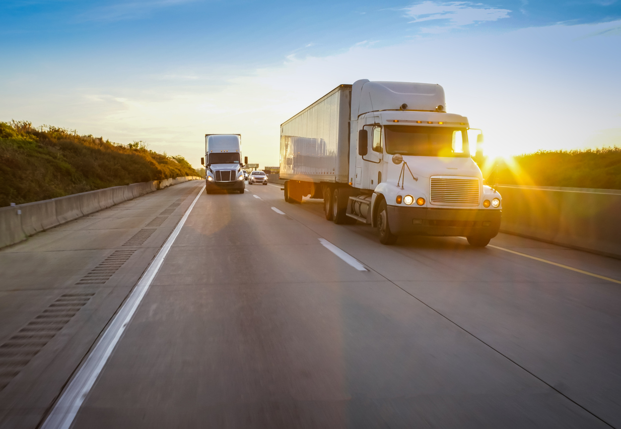
Running your commercial fleet requires more than simply sending vehicles from point A to point B. The success of your drivers and your business depends heavily on optimizing the things you can’t see once a vehicle leaves your warehouse. Vehicle Tracking Devices can optimize your fleet by providing real-time GPS updates, collision notifications, and even engine fault detection.

In this post, we’ll break down what Vehicle Tracking Devices are, the latest generation of tracking devices currently available, and how your business can benefit from this advanced fleet protection.


What Are Vehicle Tracking Devices?


A vehicle tracking device is like the black box of an airplane; it receives GPS signals, collecting and sending navigation data and other critical vehicle information. This small piece of hardware can be as small as a matchbox, or as large as a shoebox.

Most tracking devices come equipped with a SIM-card slot and an On-Board Diagnostics (OBD-II) plug to connect to your vehicle. Once connected, it receives GPS signals and sends vehicle information — such as vehicle location or driver speed — using the internet, satellite networks or cellular services. Tracking devices differ with regards to the data collected, how they attach to the vehicle, and their respective power source. Types of devices include:

  • Factory-fitted Original Equipment Manufacturer (OEM) devices
  • Plug-In devices
  • Hardwired after-market devices
  • Smartphones or tablets enabled with real-time GPS tracking


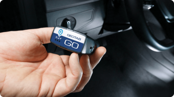
Installing tracking units can be as simple as plugging into a vehicle’s OBD-II port, or may require a qualified technician to connect the tracking device to the wiring harness of the vehicle. Most light commercial vehicles purchased since 1996 already have an internal OBD-II port, often found behind the panel below the steering wheel.

Once connected, GoFleet’s specialized tracking software can collect GPS and vehicle data. It then transmits the data in real-time to a wide variety of pre-programmed devices, such as a cell phone or a computer IP address.


Internal Data-Protection Safety Features


Each of our vehicle tracking devices has a unique code, known as the International Mobile Equipment Identity (IMEI) number. This allows GoFleet’s patented tracking software to match the unique code of each vehicle, preventing confusion and maintaining fleet management integrity.

The information collected and sent from GoFleet’s tracking devices also has a range of security features that prevent third-party penetration. These cryptographic features include:

  • Data encryption
  • Authenticated end-to-end telematic security
  • Verification of message integrity and unique IMEI tracker codes
  • Non-static security keys, which impede faking a device’s unique identity
  • Firmware with digitally-signed pre-programming to verify the source of updates
  • Validation of technology by independent third-party experts


What Type of Data is Collected?


GoFleet’s vehicle tracking devices collect and transmit a rich array of information. Even when the vehicle is parked underground or indoors, the telematic tracking unit begins recording the moment the key turns in the ignition.

Using AI and the enhanced data security features, some of the telematic information collected by GoFleet’s tracking devices include:

  • Precise Vehicle Tracking: This includes vehicle location, driving speed, engine idling, trip distance, time markers, driver ETA and more.
  • Fleet Health Assessments: Our software extracts and collects essential vehicular information such as engine faults, odometer readings, service maintenance needs, vehicle VIN, even risky driving habits such as acceleration, fast cornering or harsh braking.
  • Advanced Telematics Capture: Our trackers receive data from a variety of internal vehicular sources, such as the engine, instrument clusters, drivetrain, diagnostics and other subsystems. This allows for methodical and data-driven dashboard reports.
  • Collision Notifications: If a collision is detected, GoFleet’s superior tracking devices use AI and patented algorithms to collect and send detailed forensic data. This allows for forensic reconstruction of road events, including in-vehicle reverse collisions. This data is automatically uploaded from the tracking device, and collision notifications are sent in real-time via email or desktop alerts.
  • Driver Coaching: By providing your drivers with immediate feedback, you can improve fleet integrity and security, reduce risk to your drivers, and encourage immediate corrective action. Visible or audible alerts, as well as spoken guidance, can be given in cases of speeding, excessive idling, or unsafe driver behaviour.


GoFleet’s Advanced Vehicle Tracking Devices


Below are the latest and best vehicle tracking units available on the global market. They also come equipped for IOX expansion. This means that your tracking system and third-party integration management can expand with your fleet, allowing for scalable telematics solutions and greater fleet flexibility. IOX add-ons include: satellite tracking, driver ID, temperature tracking, hours of service (HOS), dash cam systems and more.
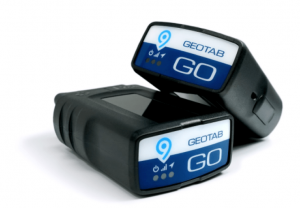
 

GoFleet’s GO9+


Welcome to the future of vehicle tracking devices. The GO9+ is the most advanced telematics device on the planet, providing industry-leading insights on the health of your fleet vehicles, as well as trip details, driver safety and much more. The GO9+ provides everything needed for advanced telematic capture and transmission, all in a tiny, compact package.

Best of all, the GO9+ brings its own Wi-Fi hotspot on-board, allowing your vehicle to stay connected to high-speed Internet without siphoning data from individual plans. In addition to reliable Wi-Fi wherever your drivers go, GoFleet’s GO9+ offers the following state-of-the-art features:

  • Unparalleled GPS tracking technology
  • G-force monitoring
  • LTE connectivity and secured communications capability
  • Intelligent in-vehicle driver coaching and alerts
  • Advanced collision detection and notification
  • Expandability of the external device via IOX Technology
  • Built-in gyrometer and auto-calibrating accelerometer
  • Instant vehicle data, including engine and battery health assessments
  • Accelerated GPS acquisition time via Almanac OTA support
  • GPS+GLONASS support and connectivity
  • Advanced native support for a variety of vehicle protocols
  • End-to-end cybersecurity measures, including non-static security keys
  • Easy installation

Recommended for: Small businesses, heavy-truck fleets, corporate vehicles and ride sharing.


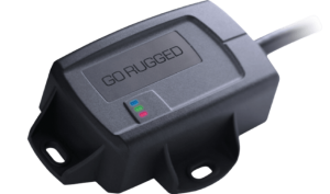
GoFleet’s GO9 RUGGED


If you need a vehicle tracker built for harsh environments, meet the GO9 RUGGED. This device is designed to withstand external installation, protecting against elements such as dust, water, dirt and other solids. 

The GO9 RUGGED builds on the GO Rugged family, providing even more speed, reliability, security features and telematic power. That’s because the GO9 RUGGED is powered by a 32-bit processor, offering 4 times the memory and 5 times the RAM of its predecessor, the GO8 RUGGED. Using GoFleet’s AI algorithms and tracking platform, the GO9 RUGGED can accurately recreate vehicle trips, analyze incidents, provide in-vehicle alerts to notify drivers of infractions in real-time, and provide end-to-end data encryption. Features include:

  • State-of-the-art GPS technology
  • G-force monitoring
  • Simple and sturdy design for covert installations
  • Smart, live in-vehicle driver coaching capacity
  • Industry-leading collision detection and notification
  • Instant vehicle data, including engine and battery health assessments
  • On-board auto-calibrating accelerometer and gyrometer
  • Accelerated GPS acquisition time via Almanac OTA support
  • GPS+GLONASS support and connectivity
  • LTE connectivity and secured communications capability
  • End-to-end cybersecurity, including authentication, encryption, message integrity verification, and non-static security keys
  • Advanced native support for a variety of vehicle protocols
  • Expandability of external device via IOX Technology
  • FIPS 140-2 validated by the NIST
  • IP68 & IP69K certified for protection from water, dust, sprays and other external pressures
  • Does not require a dash-mounted antenna or wire splicing for installation

Recommended for: Fleets using heavy equipment, farm machinery, powered trailers, yellow iron and other major assets.


Main Benefits of Fleet Vehicle Tracking


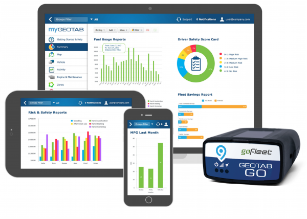
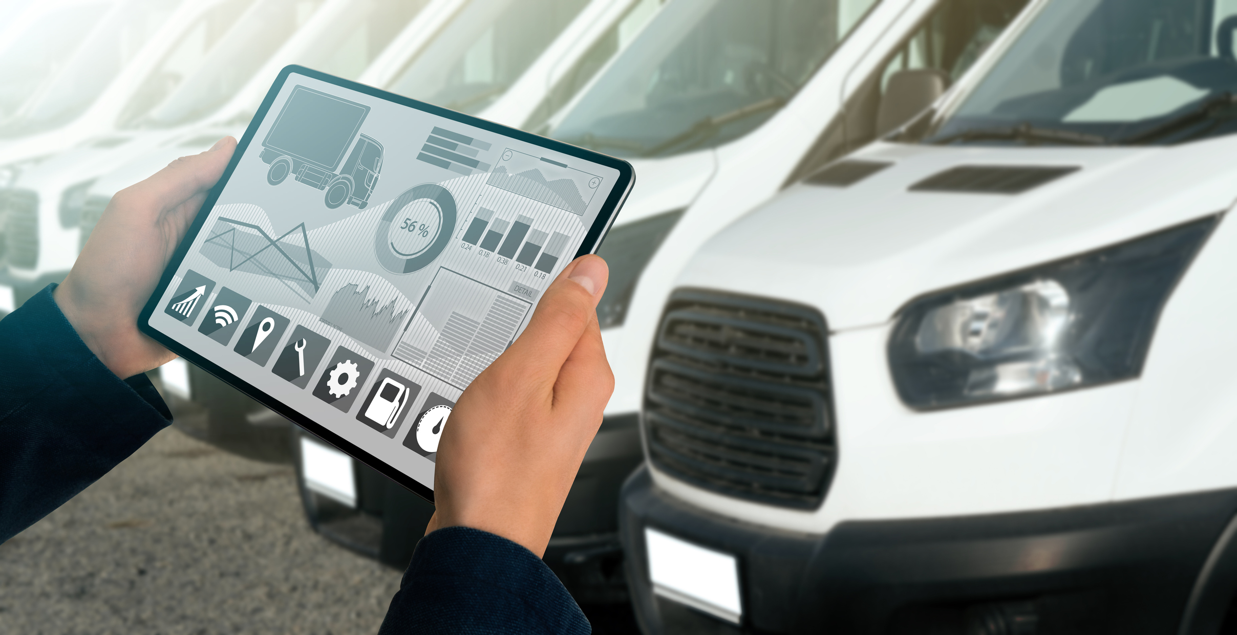
GoFleet’s tracking devices provide businesses with the hard data required to ensure smooth operations and peace of mind. Our software works seamlessly with vehicle tracking units to integrate command centre visibility into your fleet operations.

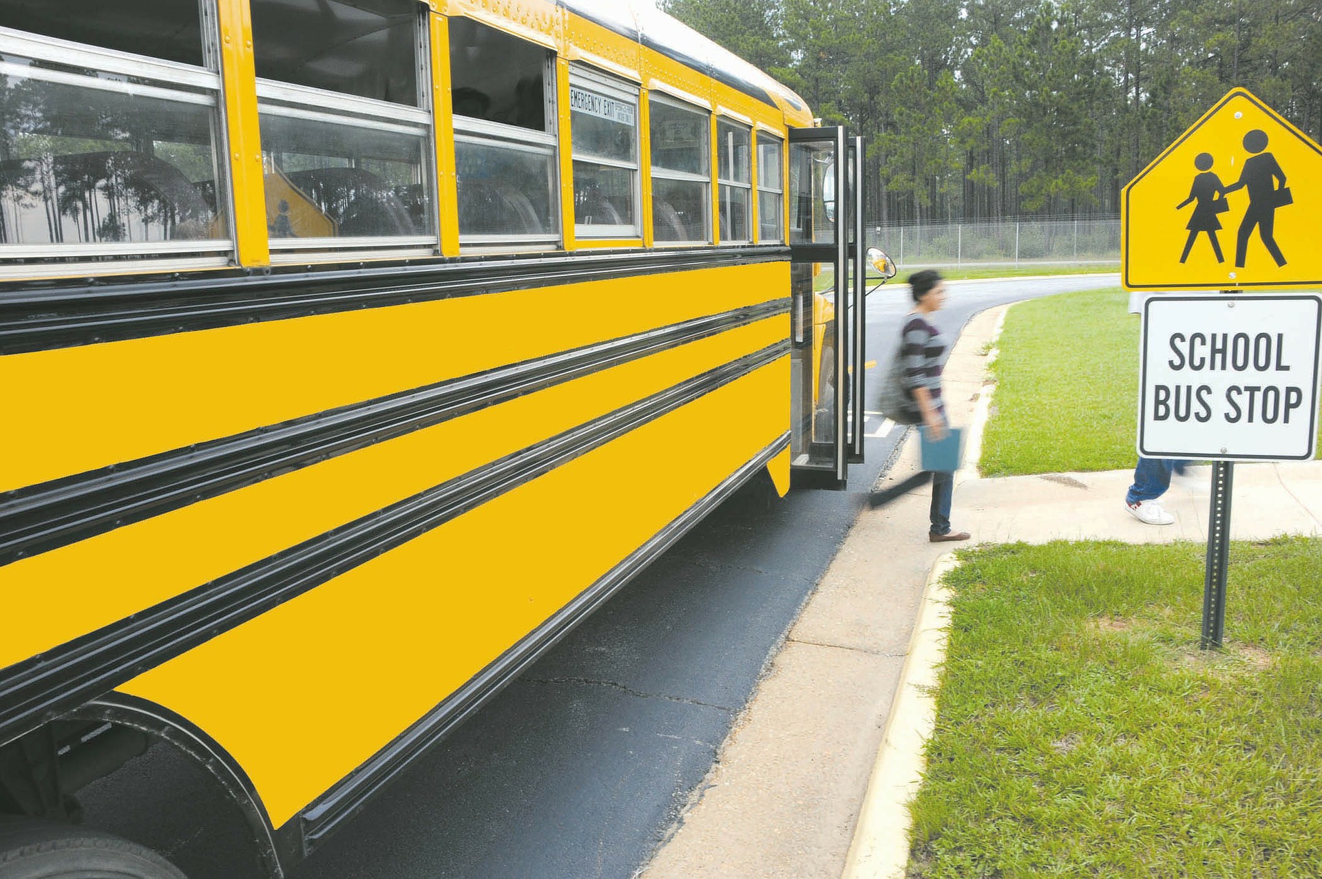
We recommend using tracking devices for businesses that manage fleets of any size, including cars, trucks, limousines, ride-sharing, pickup trucks, trailers, farm equipment, plumbing, roofing or construction vehicles. Our devices are scalable and can connect you to your vehicles, whether you have one or 100.

Among the most prominent benefits to using vehicle tracking devices are improved fleet management and maintenance, enhanced driver safety, lower labour costs, reduced fuel costs and superior theft deterrence. Additional benefits include:

  • Precision GPS technology, eliminating guesswork
  • Live updates and visibility, providing regular updates as often as every 2 seconds
  • An integrated, user-friendly fleet command dashboard; giving you access to your fleet with just a few swipes
  • Individualized regular servicing dashboard with service records for your vehicles
  • The ability to capture and view telematics data such as vehicle speed, direction, and fault codes
  • Asset monitoring, such as temperature data and asset location
  • Immediate 24/7 support for fleet owners


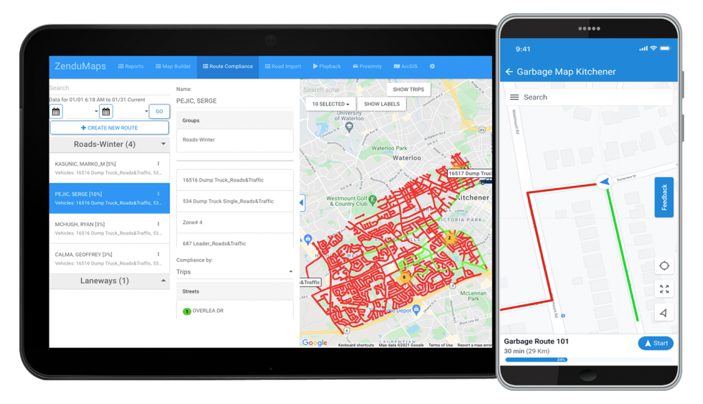
Integrated Software and Dispatch Performance


GoFleet’s tracking units let you view your entire fleet simultaneously, regardless of their location. Our devices work synergistically with individualized driver management software, letting you streamline and fine tune your fleet’s performance to ensure peak performance and compliance.

Our integrated software monitoring system allows businesses to capture when the driver’s workday starts and ends, displays routes in real-time, and records driver stops — both scheduled and unscheduled. Our data captures also record idle periods, fuel consumption, driving speeds, mileage, and even provides alerts on lost drivers or thefts.

The benefits of our integrated platform command centre to monitor dispatch performance include:

  • Ensuring drivers are on schedule and automatically sharing ETAs with customers
  • Confirming driver HOS & PTO availability, which reduces check-in calls
  • Recording Driver Scorecards and 365-day performance history
  • Alerting to acceleration, harsh breaks and collision detection
  • Streamlining routing options and dispatch management
  • Recording miles-by-state for IFT
  • Assuring FMCSA 395.15 compliance
  • Locating lost drivers and aiding the recovery of stolen property.


Ready to Protect Your Assets?


With all of the benefits of vehicle tracking devices, can your business afford not to invest in a telematics solution that saves you time, money and resources? Our experts can help you determine which asset tracker best suits your fleet’s needs. Schedule your free consultation and demonstration today. 

telematics, report, gofleet, gps, optimization, fleet, vehicle

What Is Telematics? An In-Depth Look

In the most general terms, telematics is the fusion of telecommunications (e.g. phone lines and cables) and informatics (computers) to create a holistic overview of one’s enterprise. Most often, telematics solutions are applied to commercial fleets, automating and leveraging the collection of GPS data across any number of assets.

While certainly not a new industry, the telematics field stands at the precipice of massive growth opportunities. The following is GoFleet’s primer guide on telematics; we’ll show you how it works, the types of data sets that are collected, and how to harness the power of telematics to increase your productivity and profitability. 


How did telematics start?


The digital science of merging telecommunications channels with information technology (or informatics) began In the 1960s, when The Department of Defense in the U.S. developed GPS — the Global Positioning System. GPS was created specifically to trace the movement of their domestic military assets and improve internal communications.

As the internet expanded, more telecommunications networks went up, transferring data in real-time and enabling information to travel remotely, automating the capture of detailed data for a variety of purposes. Telematics was also made possible due to technological breakthroughs in machine-to-machine communication (M2M) — highly intelligent computer devices that gather and analyze mass data to manage real-world systems.

Today, vehicle telematics integrates wireless communications, GPS navigation, third-party software platforms, hands-free cell phones, automatic driving assistance systems and message encryption. Telematics systems can report on a vehicle’s speed, idling, tire pressure, driver habits, engine fault codes, collision detection and much more.

Added to the tracking device hardware, GoFleet’s software platform, AI algorithms and other patented knowledge allows for accuracy, quality and protection of GPS and other data transference. Known as ‘curve-logging’, this allows our software to discard unnecessary information, while preserving and logging the most useful vehicle maintenance data.


How telematics works


With regards to fleet tracking, vehicles equipped with Vehicle Tracking Devices; small, durable black boxes that provide superior GPS and asset tracking technology. These telematics devices often plug into an OBD II or CAN-BUS port in the vehicle. Paired with a SIM-card and on board modem, the units enable constant communication across all cellular networks.

The asset tracking, vehicle information recording, and communications transmission devices involved in telematics logging include the following key components:

  • GPS receiver
  • Engine interface
  • SIM card
  • Accelerometer
  • Buzzer or other audio messaging
  • Interface for input/output (expander port)

The devices then retrieve and record an enormous amount of data generated by a vehicle, and transmit that data through cloud technology, providing fleet towners with dashboard reports and command-centre visibility into their operations.

Since telematics devices connect to a vehicle’s sensors and hardware, the type of data they process and analyze includes:

  • Real-time GPS positioning
  • G-force and vehicle speed, measured by a built-in accelerometer
  • Trip distance, routing and time
  • Idling time records
  • Fuel consumption
  • Harsh braking, hard cornering, rapid acceleration and other bad driving habits
  • Seat belt usage
  • Vehicle faults, engine light information and other engine data
  • Battery voltage and vehicle temperature
  • Service reminders and other vehicle maintenance warnings

All of that data is captured, encoded and then transmitted through fleet management software. It is then decoded for authorized, preprogrammed users, allowing for secure transmission of actionable data to IP addresses or cell phones.

This provides the command-centre data needed for generating, viewing and exporting dashboard reports. Business intelligence insights can even create driver scorecards — identifying safe drivers, speeding incidents, or opportunities for scheduled maintenance.


Telematics in fleet management


Telematics has become an essential tool for commercial and government fleet management. In addition to tracking major assets across the globe using GPS, advances in machine learning and data analytics mean improved fleet performance and productivity. Fleets can even use benchmarking measures to compare safety, fuel consumption or other standards against similar fleets.

One indispensable feature of telematics in fleet management is the creation of advanced analytic comparisons. This provides fleet managers with hard data that can be used to identify optimal travel routes, deter theft and protect assets.

Though telematics data can be stored and sent from closed-vehicle systems, most often a fleet’s telematic technology is shared through open platforms via proprietary software. This allows businesses to integrate other hardware, after-market accessories, and third-party apps for greater efficiency, expandability and insight into business operations, while retaining data privacy.

As telematic devices continue to improve, the most popular telematics integrations for fleet management currently include:

In fact, vehicle security and identification sensors have improved so much that fleets can now authenticate a driver’s identity before they are able to start the vehicle.

Every day, more businesses, nonprofits and government agencies move toward the hard data and superior protection that telematics affords. According to Allied Market Research, the automotive telematics market was valued globally at $50.4 billion in 2018. By 2026, experts believe it will reach $320 billion. 

The benefits of telematics are self-evident; they offer diagnostic tools that prolong the life of vehicles, warn of pending issues and identify areas of concern. Telematics contribute to ROI and savings so exponentially, Verizon recently wrote: “32% of fleets using fleet management technology achieved a positive ROI in less than a year,” sharing this and more data points in their 2021 Fleet Technology Trends Report.

Industries currently employing telematics for their fleet tracking include:


The benefits of telematics for commercial fleets


The applications for telematics cannot be understated; it harnesses a rich ecosystem of information — from granular drivetrain details to post-collision reconstruction of driving events — ensuring the health of your vehicle and the safety of everyone on the road.


Safety tracking:


Fleet managers can use telematics to monitor the speed and location of their vehicles, as well as ensure that drivers employ good driving habits now and in the future. In the event of an accident, telematics can help identify who was at fault and what the road conditions were prior to the event, ensuring the safety of their drivers and preventing future incidents.


Maintenance:


By understanding the entire operational life cycle of their vehicles, including hours of service (HOS), warranty recovery and preventative maintenance scheduling, managers can find areas of improvement and identify problems before they occur.


Insurance:


Insurance companies can leverage telematics data to assess risk factors within a fleet and adjust premiums accordingly. Factors such as accidents, fuel consumption and engine wear can all determine — and possibly lower — insurance rates for your fleet.


GoFleet telematics support


GoFleet and our trusted partners have identified seven key areas where fleet management receives the greatest direct advantage from telematics support:

  1. Improved Productivity: Using real-time GPS tracking and automatic trip reporting, fleets can greatly improve dispatching, routing, ETA notification and customer service.
  2. Increased Safety: In-vehicle driver coaching alerts to drowsiness or other risky driver behaviours; collision reconstruction and theft location notifications help protect your assets.
  3. Optimization of Fleets: Streamlining vehicle servicing with predictive maintenance and remote diagnostics improves fuel management, driver habits and vehicle integrity.
  4. Fleet Compliance: Automates FTA reporting, inspections and compliance logging.
  5. Platform Integration: Makes sure all your mobile asset apps and equipment communicate seamlessly, integrating camera, sensors, CRM technology and more.
  6. Adaptable Sustainability: Reduces the environmental impact of carbon emissions, adapts to emerging power sources, and analyzes the cost effectiveness of electric vehicles.
  7. Insurance Premiums: Because fleets can now share their safety compliance data as proof with insurance companies, risk assessments often generate lower premium costs.


The future of telematics


As GPS tracking systems and M2M technologies advance, the Internet of Things (IoT) continues to grow; every advance made brings us closer to the edge of a telematics revolution. From enhanced collection and capture of intelligence data to performance benchmarking and reporting for fleet optimization, the future of telematics is bright. Contact your GoFleet consultant to discuss how telematics can bring tomorrow’s technology to your fleet, today. 

beginners guide, eld, electronic logging device, gofleet, mandate, trucking, hos, compliance

A Beginner’s Guide To Electronic Logging Devices And Current ELD Mandates

Back before the days of automation, truck drivers had to manually log their trips. Even after countless hours on the road, drivers were still responsible for tracking their movements, often spending additional hours accounting for every stop and start. Fortunately, the advent of Electronic Logging Devices (ELDs) removed that labor-intensive step by digitally automating the logging process.

Over the past four years, governments in the U.S. and Canada enacted ELD mandates for most commercial vehicles. Transport Canada has been working diligently to align with the ELD Mandate passed in the United States, which states that providers must obtain certification from a third-party to ensure their solutions meet the complex technical standards set forth by Transport Canada.

Fortunately, the jump to electronic logging has made issues of compliance far easier. GoFleet’s electronic logs capture all necessary logging information automatically, allowing drivers to record on-duty hours with great detail and freeing them up to focus on the road..

In this post, we’ll cover some of the many advantages of using ELDs; we’ll simplify how they work, what they record, and identify the key dates to comply with the current ELD mandates.


What Is an ELD?


Electronic logging devices often plug into a vehicle’s onboard diagnostics (OBD) port. The ELD vehicle tracker then connects directly to the truck’s engine, sending data safely through mobile apps and GoFleet’s software and fleet management platform.

These telematics devices can send granular engine data — when it was turned on or off, how much fuel was used, how far the vehicle travels — along with GPS global satellite system location data. The telematics are collected and then sent securely to a server, for easy ELD mobile app viewing.

Drivers can likewise access their electronic logging information on their smartphones or tablets using our ELD mobile app. RODS and HOS records can be displayed for vehicle inspectors. This technology streamlines the capture and retrieval of massive amounts of records and receipts.


Types of Logging Data Captured

ELDs help fleet compliance managers monitor and analyze safety protocols. GoFleet’s data captures translate into real-time ELD reports showing location information, maps and a wide range of notifications. Data logging captures include:

  • Automatic recording of on-duty driving time, driving behaviour and driver authentication
  • ELDs communicate directly with the engine control module for internal synchronization
  • On-board gyroscope and accelerometer detect movement, providing data around safety-related events such as harsh braking or collisions
  • Automatically records locations, date and time stamps, engine hours, ignition status, vehicle miles driven, motor carrier type and more
  • Provides driver recertification records at the end of every 24-hr period
  • ELDs offer tamper prevention, sending out real-time vehicle location information
  • ELDs also transmit data—constantly to fleet command managers, and locally, on an individual basis, to DOT and other commercial vehicle inspection sites
  • Displays reports on-demand (on screen or print-outs) for safety officials


The Advantages of ELDs


Smart technology has revolutionized most industries, and its effects on commercial vehicles is no exception. ELDs offer enormous advantages for drivers and their parent companies. Among the most frequently cited:


1. Road Safety


Most ELDs have a gyroscope and accelerometer, which detect trigger events such as harsh braking, harsh turning and collisions. The resulting data can be used to coach drivers on safe driving, alert to driver drowsiness and even provide collision reconstruction data, which can be used to exonerate drivers from false claims. Electronic logs for truckers have become so effective that governments are mandating their use to improve driver safety, increase vehicle efficiency and save lives.


2. Streamlining Record Keeping


Record keeping and reporting is an important — if not tedious — part of any fleet’s operations. ELDs help commercial fleets simplify the process, automating the collection of Records of Duty Status (RODS), tabulating drivers’ Hours of Service (HOS) for compliance, and enabling robust reporting while simplifying administrative tasks.

Automated tracking minimizes the risk of records errors, which ultimately makes the process of enforcement checks faster. Using GoFleet’s integrated software platform, ELDs can also provide dashboard reports and internal checks on each vehicle’s integrity, with alerts for scheduled servicing dates to avoid problems before they start.


3. Asset Security


The security and loss prevention provided by ELD solutions includes real-time GPS satellite data, encrypted from end to end. Vehicles can be located easily in the event of theft, and in many cases theft can be prevented altogether.

The geofencing feature on ELDs creates a virtual boundary around a given location, and sends an alert any time a vehicle breaches the boundary, minimizing loss and reducing the cost of replacing assets. Real-time data captures everything from micro data on drive-chain stability to macro data on driver behavior and HOS, granting your fleet command-centre visibility.


4. Cost Benefits & ROI


By streamlining and upgrading the record-keeping process, your fleet can travel faster and smarter. Moreover, fleet managers can more easily identify areas for efficiency and cost savings. This is especially true with route mapping and capturing idling time, both of which dramatically reduce fuel costs.

In the event of a collision, forensic accident reconstruction and recording of harsh driving events help minimize liability and reduce insurance premiums while also serving as an opportunity to effectively coach your drivers on better driving habits.


5. HOS Compliance


The Hours of Service (HOS) Rules ensure that commercial drivers operate their vehicles within the daily limit and log working hours accurately using an elog app or electronic logbook. Because ELDs connect directly to the vehicle, they make it easier and faster to track, manage, share and improve the accuracy of a driver’s hours of service record. 

The devices ensure drivers comply with the Canadian Government’s Commercial Vehicle Drivers HOS Regulations by tracking when drivers have been at the wheel and for how long.

In this light, ELDs will make it easier for drivers and motor carriers to comply with the regulations by staying within legally allowed driving hours.


Recent ELD Mandates: Who Needs ELDs?


Deadlines loom for recent inter-country ELD mandates, making it likely that all North American commercial vehicles will have to adapt to this technology soon. At present, only commercial vehicles older than model year 2000 are still exempt. Some highlights on the mandates:

Canada’s ELD Mandates & Key Dates


Canada recently published its Regulations on Commercial Vehicles, which require Electronic Logging Devices for all commercial fleets by June 12, 2022.

Canada’s move to ELD reporting began in 2017. By June 13, 2019, Transport Canada had begun mandating ELDs for bus operators and commercial trucks. By June of 2022, Canada is expecting all fleets to have switched from daily paper logs to ELDs. Other regulatory mandates include:

  • Canadian ELDs must meet Electronic Logging Devices standards and minimum requirements.
  • Canadian ELDs must be third-party certified, not self-certified by the manufacturer, as in the U.S.
  • Canadian drivers will not transfer logs electronically to a federal system, like eRODS in the U.S. Instead, drivers will be required to email transfer files to officers.
  • There will no longer be a two-year phase-out period for ERDs; fleets must achieve ELD compliance by the 2022 date.


Canadian ELD Exemptions


Canada offers four main exemptions in their recently updated ELD regulations. Commercial vehicles may be exempt from the eLogs mandate if they meet the following criteria:

  • Operate the vehicle under a specifically issued permit
  • Are subject to rental agreements with terms under 30 days
  • Have a prior statutory exemption
  • Operate a vehicle that was manufactured before model year 2000

Canadian drivers of commercial motor vehicles manufactured before 2000 can continue to keep paper logs to track driving time and on-duty hours records.


U.S.A.’s ELD Mandates & Exemptions


ELDs are currently required of all fleet industries in the U.S. whenever any one driver logs in eight days worth of duty status logs or more (out of 30 days). The U.S. ELD mandates went into effect back in December 2017, with an expectation of full compliance by December 2019. The FMCSA will allow exemptions for drivers who:

  • Are not required to keep Record of Duty Status (RODS)
  • Drivers who use RODS for no more than eight days during any 30-day period
  • Tow-away drivers, if the vehicle driven was part of a shipment
  • Drivers of commercial vehicles older than model year 2000

The FMCSA also recommends consulting their site to verify how your fleet is affected by the ELD trucking rules changes.


Meeting ELD Requirements 


There are many similarities between the American and Canadian ELD mandates. Both require engine synchronization, GPS tracking, automatically capturing on-duty and off drive-time, and the use of an on-screen display to show records to roadside inspectors. 

There are also some major differences between the two nations; Canadian mandates will require the ELD system to actively alert drivers when they are running close to their hours of service limits. The hours of service rules in Canada are also quite different from the U.S.

As a fleet manager, it’s important to stay detail-oriented. For trucks travelling within Canada, fleet managers should choose an ELD vendor and carrier that supports Canadian hours of service rules, and are committed to achieving third-party certification.


GoFleet to Get the Details


As everyone works towards full compliance, we at GoFleet are tracking recent electronic logbook changes to stay apprised of any developments or changes. Our ELD solutions provide industry-leading insights, while our electronic logs for truckers help simplify record keeping, providing commercial fleets peace of mind.

As technology and connectivity become ever more integrated, it’s important to choose your solutions wisely. Ask us about our Geotab Drive ELD, an FMCSA compliant app for mobile devices that provides Driver Vehicle Inspection Reporting (DVIR) and Hours of Service compliance solutions, in real-time.

All of our integrated ELD solutions save you time and money. Contact us to schedule a free consultation or trial demonstration to see how your fleet will be affected. Our experts can help you strategize and streamline. 

shuttle bus, bus eta, gofleet, telematics, gps, vehicle tracking,

How Telematics Can Set Shuttle Bus Services Up For Success

If you’ve ever been in an airport, visited someone in a hospital or required private transportation to an event, you’ve likely used a shuttle bus. In today’s fast-paced world, telematics provide benefits to shuttle bus fleets, giving businesses an edge for retaining top-tier employees while providing peace of mind to commuters. Every year, more companies invest in shuttle services; with the right telematics solution, those same companies can also realize improved productivity, visibility and efficiency. 


Tracking


Vehicle tracking platforms, such as GoFleet’s Bus ETA, provide essential information to drivers, fleet managers and to public citizens to ensure a seamless, automated experience. Ultimately, tracking saves you valuable time and resources, offering a window into your current operations, inefficiencies along routes and reporting features.


With the app, passengers can review live ETA data right on their phones, with just one click. They can view current vehicle routes, expected total route time, as well as stop and start points, all in real-time. Automation streamlines these processes by reducing wait times and reducing the number of inbound callers for real-time updates, while fostering goodwill with passengers.


Passenger Safety


GoFleet has a number of product offerings that can be scaled to your fleet’s requirements, including commercial dash cams such as ZenduCAM. Perhaps one of the best use cases for ZenduCAM resides with shuttle buses. Imagine being able to track passenger safety by ensuring that your driver follows all necessary protocols. Dash cam footage keeps your drivers compliant, keeps your commuters safe, and helps reinforce good driving habits.


Vehicle Diagnostics


When you use a GoFleet product or service, you’re leveraging a rich telematics ecosystem that can provide all kinds of data sets to improve your business. Monitoring the health and productivity of your shuttle vehicles is an essential part of any holistic fleet solution. Connecting fleet vehicles and fleet managers in real-time and with daily or historical reports for optimum fleet performance.


Our GO9 GPS vehicle tracker, for example, not only provides accurate data on vehicle location, speed and trip distance, it can also extract valuable data on a vehicle’s overall “health”, letting you know the status of the odometer, engine faults and much more. Connecting fleet vehicles with fleet managers in real-time helps to gauge when and if a vehicle requires maintenance, track fuel efficiency and reduce the time and frequency of inspections, all of which stop vehicle problems before they start. With the right diagnostics tool, you can easily optimize your fleet’s performance and save money in the process.


Telematics data is critical to the success of nearly every type of fleet. GoFleet’s solutions are comprehensive, scalable and offer easy installation and a user-friendly interface. Whether you use shuttle buses to manage guest parking, take travellers to and from the airport or need your commuters to arrive at any destination efficiently and on time, we can help you take full control of your fleet’s operations for better business outcomes. Contact one of our consultants today to see how GoFleet can work for you.

back to school, school bus, student, tracking, telematics, gps, parents

Back to School Brings New Telematics Opportunities For Bus Fleets

This month marks the back-to-school season, offering students across the country a mass exodus from lockdowns and a welcome break from online learning. These new beginnings bring with them opportunities for school administrators and third-party fleet managers to revamp their bus operations using technology and telematics data to make the school year safer and more efficient. Below we’ve listed some of GoFleet’s product and service offerings that are available to both schools and to the public to help keep kids safe.


GPS tracking of bus operations with Bus ETA


GoFleet’s Bus ETA app marks the first step in safety and communication between parents and their child’s school. Bus ETA is an app that allows school admins to provide live location updates of arriving or departing school buses. 


The app also allows parents to track their child’s bus to make sure it arrives/departs on time by allowing the parent to create routes and define which students (or “Travellers”) are assigned to those routes. Bus ETA is updated automatically, so that parents (or “Guardians”) have access to real-time updates on their computers, tablets, or mobile devices.


Bus ETA is integrated with ZenduIT ecosystem (same functionality as ZenduCAM alerts) to create and review multiple routes, monitor multiple travellers and allow their guardians to log their information in the event of an emergency. A 2-step verification process ensures safe guardian login.


Knowing when and where a school bus will be at any given time — and having that information available on a live app — improves efficiency by reducing wait times and avoids having to wade through a field of update calls from anxious parents. Routing and dispatching can be done quickly, providing a live location for all buses employed by the school and increasing visibility between parents and the school’s administration. 


The school can import and manage guardians and travellers while creating and managing routes from the travellers addresses. Conversely, guardians can track several bus routes and travellers from one mobile app while reviewing a history of arrivals and notifications. Ultimately, knowing when and where a bus will arrive allows families to organize their day without the fear of missing a ride to school. 


Tracking student safety with GO9 trackers


It’s all well and good to know where the bus is, but what if your child isn’t on it? Thankfully, Bus ETA can merge seamlessly with ZenduIT’s tracking system for a more comprehensive (and safer) solution. For example, our third-party GO9 tracker plugs directly into the vehicle to track its routes, and a traveller tag tracks the student’s mobility when used in conjunction with a GO9 + NFC reader. Whether you’re tracking your child’s bus, or tracking the bus and your child, our technology gives schools and parents peace of mind while promoting safe travel to and from school.


ZenduCAM for heightened safety


Our commercial dash cam solutions provide a wealth of options for fleets of all sizes. Connecting a product such as ZenduCAM to your buses gives you data sets for all kinds of cost-saving and safety-promoting initiatives, including:

  • Accident reconstruction: In the unlikely event of an accident, ZenduCAM helps you determine who was at fault, as well as the events that led up to the collision.
  • Road compliance: Dash cams keep your bus drivers accountable by preventing unsafe driving habits such as rapid acceleration, harsh braking and turning.
  • Passenger-facing cameras can help scan your precious cargo to keep them safe and accounted for.
  • Driver scoring and training: Your dash cam system provides an overall scoring system to help identify areas of improvement, incentivize good driving habits and keep drivers and students safe.


When integrated with GoFleet’s rich telematics ecosystem, Bus ETA can help create a 360 solution for schools and bus fleets. Through years of IoT experience, our specialists have a wealth of knowledge and an ability to recommend the right integration of apps and hardware for different verticals. We design, develop and implement premium automation solutions to help drive success — and your vehicles. Contact your GoFleet consultant today and see how we can bring your bus fleet to the top of the class.

school bus, fleet, gofleet, fleet management, school, back to school, bus eta, telematics

Spotlight on Telematics, Bus ETA and Back to School: A Conversation with Kemal Leslie

Kemal Leslie, a strategic consultant to GoFleet, talks about Lord Selkirk School Division’s biggest pain points, and how GoFleet’s comprehensive and integrated telematics solutions solved some of their biggest back to school issues.


Tell me a bit about LSSD and the kinds of things they were looking for.


KL: They began working with GoFleet a few years ago to help them manage their bus fleet maintenance and location tracking. This also included management of driver operational safety. 


How did Bus ETA factor into the equation?


KL: At that time, they were also looking at Bus ETA as a solution, where a student or parent of a student, for example, could know when the bus is on its way to pick up or drop off, as well as the whereabouts of that vehicle. This has become a more popular solution over the last, I would say, five or six years, where parents or students want to know when to arrive at the bus stop. 


So it seems that Bus ETA also offers peace of mind?


KL: Well, for safety and security reasons, they received feedback that parents want to be able to track kids’ travel to and from school. They wanted an easy way to oversee their safety. That’s what the Bus ETA application really was about.  


What were the other components of your proposal?


KL: At that time, GoFleet implemented not only their bus tracking and status reports, but had also integrated another solution called On Command Connection with their Geotab telematics system, which is a diagnostic maintenance offering under Navistar. Their maintenance provider can track their buses and advise if any need to be repaired based on automated scheduling and alerts from real-time vehicle data; their maintenance team can call in a repair just by looking at the status report that’s provided through On Command.

Finally, Transfinder became the next third party integration for this solution. It’s a mobile application that tracks where the student is; if they are on the bus, when the bus is arriving, that type of thing. The system actually utilizes Geotab telematics data to manage the reporting within the application where the student might be at any given time, or where the bus is in terms of its daily trips.


So in terms of the evolution, it started as a fleet management application to manage the hardware, the equipment, location status, etc. And then student tracking for parents was integrated to centralize everything within their GoFleet solution.


That sounds really comprehensive. What are some other applications for this system outside of LSSD?


KL: Well, the entire solution could serve many verticals really, either in part or as a whole integrated solution. The fleet management piece can apply to any industry that requires management of their own automated fleet — it could be heavy equipment, trucks, small vehicles — any of that can be adapted to use this functionality. 


The same goes for the maintenance piece; to be able to connect to and manage the fleet without needing to bring in the vehicle, to have diagnostics established if there’s a problem with a unit and it needs to be called in. Those things can adapt to pretty much any industry.  


And what about Transfinder?


KL: I think that the Transfinder solution, as it relates to tracking when a vehicle is coming to pick someone up, certainly has its application in schools. But it would also have applications for other transportation clients, really any type of privatized or public transportation, the TTC for example. There will always be people who could use an app to tell them when to expect their ride. 

All in all, I think it’s a pretty robust solution; the equipment management piece, the maintenance piece and the transportation communication piece. Operators benefit from having a really strong, interconnected solution that provides important efficiencies.

Interested to learn more about how GoFleet’s solution could help your fleets unique needs? Contact us today by clicking the button below!

government fleets, telematics, gofleet, fleet management, productivity

How Government Fleets Can Benefit from Telematics Solutions

Local government and public works agencies rely heavily on datasets to improve their operations, satisfy their constituents and plan their community more effectively. What typically remains top of mind for most government agencies is the safety and satisfaction of their citizens. To this end, telematics can help achieve these goals by providing visibility into the inner workings of their services and fleets, creating a partnership with the public rather than an autocracy.


From vehicle tracking to functionality, telematics can have a positive impact on government operations. For example, a winter maintenance fleet manager can have specific data at his fingertips, including when plowing occurred and when, and even how much salt is left in a vehicle. The right telematics solution will help save costs, improve safety and overall operational efficiency, and help fleet managers monitor the status of services while tracking their assets on a single platform. Here’s how telematics can improve your government operations.


Single sign-on


Not all government vehicles are plows and spreaders, which is why it’s important to be able to manage all assets within your organization through one system. Managing your entire fleet through one platform reduces training, reinforces information and highlights inefficiencies.


A centralized, cloud-based “single source of truth” allows you to track assets in real-time while managing their maintenance and controlling costs. Telematics can automate your processes and eliminate hours of manual data processing, giving you more time to focus on decision-making, training and efficient operations.


Automate and manage your assets


Government organizations provide essential services and critical infrastructure that support the daily activities of residents and businesses. In addition they are responsible for maintaining service level agreements, infrastructure planning, policy and ensuring the best use and deployment of expenditures and assets.


Because government fleet managers and leaders typically oversee a diversity of vehicles and assets (usually in the form of unique GPS tracking), an integrated telematics solution would offer full visibility into the operational data of all government vehicle types on a single platform, providing the tools to maintain compliance and road safety while reducing costs.


When you increase your fleet’s capabilities, you can measure material usage and ensure equal delivery of services within the community. Ultimately, these datasets lead to lower costs and a reduced environmental impact.


Asset health


Whether seasonal or otherwise, repairing infrastructure and conducting road work is tough on vehicles and assets. Telematics allow you to monitor asset performance to ensure you get the most out of them. When you track asset utilization, such as average daily mileage and service history, you can increase their lifespan and improve your bottom line.


The right telematics solution will compile both historical and real-time data usage so you can proactively decide how best to maintain and use your assets. From forecasting future repairs to predicting vehicle replacement, the fleet reports offered from telematics data give valuable insights into performance and maintenance, giving you a holistic overview of your fleet’s health.


Increase productivity


The unfortunate truth about many government operations is the tendency towards using old management methods, such as spreadsheets, that offer little to no insight into asset usage. When you don’t know the health of your fleet, you can’t prepare for potential work, which can lead to unplanned downtime and reduced efficiency. It is essential to have an automated telematics management system that can track and manage your fleet in real-time so you can maintain productivity.


Manage public perception


In the end, government fleets answer to the governed. Give your community access to visibility and help fight false claims with historical reporting and analytics. Provide proof of vehicle location and services rendered; show your constituents how to track vehicles themselves with a public map they can easily access and maneuver. Transparency can foster a positive relationship with the public and improve overall satisfaction. 


Use telematics to turn your fleet data into insights and action. Support your key government business drivers, including asset management, compliance, accountability, and efficiency. Contact your GoFleet specialist for your special offer, and schedule a demonstration today.

zendumaps, gofleet, gis, mapping, winter maintenance, waste management, city works

6 Industries that can benefit from ZenduMaps

By now, you’re familiar with the ZenduIT mapping software system that we offer ZenduMaps, which offers real-time location-based operations management that benefits fleets across a number of industries. The use of telematics is becoming increasingly prevalent among fleets, and managers of all kinds are beginning to understand the benefits of tracking vehicle location, driver behavior, work planning and so much more.


While the more obvious applications for ZenduMaps might include winter maintenance and seasonal road work (read more about the advantages of ZenduMaps for public works here), there are a number of operations that could benefit from this powerful fleet management tool. 


City Planning


Geographic Information Systems (GIS) have been very successful tools for urban and rural planning over the last several years. Whether the task is planning for new roads, working out local taxes or planning the next desirable neighborhood, the data gathered from ZenduMaps can help develop a new city, track its expansion and plan the direction of future growth.


Using GIS data, cities can manage planning, analysis and reporting — all factors that are necessary for successful building. With this secure, cloud-based software, stakeholders across local government and private organizations can be engaged to ensure that zoning, city bounds, street names and more are accurately and efficiently mapped. The platform provides geospatial data sets that deliver more effective solutions for planning management and city operations. 


Waste Management


The ZenduMaps platform has integrated tools to help improve productivity and reduce costs, both of which address common challenges within public works, but can be applied specifically to waste management. The public sector has a unique set of needs; waste collectors have the double task of clearing garbage quickly, efficiently and on a regular cadence, while appeasing constituents . 

ZenduMaps can manage and optimize waste collection vehicles, increase productivity and encourage fleet managers to adhere to waste collection schedules. The routing function increases fleet visibility and efficiency, while optimizing pickup schedules and litter control. Moreover, scheduled pickups and routes are searchable and viewable by the public, which fosters goodwill and keeps citizens informed.


Government


Government contracts represent some of the biggest use cases for ZenduMaps, as well as some of the greatest accountabilities. In this instance, GIS data can track all vehicles, assets and routes on a live map, allowing you to receive alerts based on predetermined triggers. The platform can also produce maintenance schedules and reports to reduce fuel costs and maintain vehicles before a problem arises.


The mapping of service locations and routes offers real-time feedback on completion rates and allows government agencies to proactively detect missed services or insufficient resources before they become a problem. 


To help manage public perception, the public can gain visibility into historical reporting and analytics for service verification, including work location with date and time stamps. By benchmarking the capacity of staff and equipment, an agency can verify the need for additional resources, or reallocate existing resources to other projects.  


Transportation


GIS data is commonly used for managing existing transportation issues while allowing those agencies to plan ahead for new roads and routes. The ZenduMaps solution offers fleet managers full visibility into the operational data of all government vehicles on a single platform, and provides the tools to effectively reduce costs, maintain compliance and ensure road safety.


Water Utility


One of the most critical areas for geospatial technology is water asset management. Mapping solutions provide water utilities with improved asset management capabilities. Creating smart, connected networks with water utilities can ensure clean drinking water for a community, a city, or the global population. In this case, agencies can accurately and efficiently maintain the utility’s infrastructure to help meet the increasing demand for water.


In addition to tracking water pressure and monitoring potential leaks, GIS mapping technology plays a vital role in digitizing water networks, and can help provide valuable insights into locations and assets, including pipes and reservoirs. Data gathering, both historical and current, can help water utilities plan new infrastructure projects and provide a complete picture of the utility’s performance. Water managers can use this technology to improve service levels and ultimately improve customer satisfaction. 


Agriculture


Pursuant to the development of water utility infrastructure in cities, GIS data also holds sway in rural areas where water is essential to the agricultural industry. The availability of water directly affects crop production in a given region; GIS mapping can produce efficient techniques for farming, identifying crops and determining yield. GIS data can also help analyze soil data, which increases food production.


The goal of a mapping platform is to reduce costs while improving efficiency, operational effectiveness and quality of service. Speak with one of our consultants about implementing a solution for your industry. Contact us now for your free trial!

3g, fleet, networki, 5g, lte

The sun is setting on 3G. Is your fleet prepared?

Major wireless network carriers are in the process of phasing out their 3G networks – commonly referred to as the 3G sunset. This is the period when wireless carriers will shut off their 3G services to make room for upgraded connectivity. When this occurs, all devices that are not 4G (LTE) compatible or higher will no longer receive cellular service, The period when wireless carriers make room for upgraded connectivity by shutting down existing 3G services is most commonly referred to as the “3G sunset”. All devices that are not 4G and LTE compatible (or higher) cease to receive cellular service after the transition is complete. 


While the 3G network shutdown is not expected to be completed until the end of 2022, wireless network carriers are already starting to phase out their 3G networks. With 4G and LTE services now on the horizon, the time to plan ahead is now.


What does the 3G sunset mean for my existing telematics solutions?


The 3G sunset means different things to different fleets; for fleets that haven’t yet upgraded their devices, it could mean loss of connection to vehicle and driving data. To prevent loss of data transferring (and signal), fleets with 3G vehicle tracking devices will need to upgrade to 4G devices. 


Conversely, the upgrade to 4G and LTE will provide users with a wider range of capabilities, including enhanced connectivity and speed, faster download speed and wider support for streaming and video interactions. Unfortunately, this means that 3G devices will no longer work or be supported.


What can I do to prepare?


Fleet managers will want to check all of their installed devices to determine how many still operate on a 3G network. You will definitely want to consider reaching out to your GoFleet Account Manager to determine whether your devices are 3G or 4G, as well as what plans are available to you in order to avoid disruption of service. 


Fortunately our team prides itself on expandable, scalable business solutions for fleets of all sizes. Your account manager will be more than happy to work with you to create an installation plan for your new 4G devices to ensure a seamless transition.


Fleets can start protecting their technology investment by selecting devices and telematics solutions that are scalable and adaptive. Don’t be caught in the middle of a massive service disruption by assuming the 3G sunset doesn’t apply to your fleet. The move towards 4G — and increasingly 5G — is inevitable. Knowing what lies ahead and adopting flexible technology will help your fleet stay agile.

cityworks, mapping, zenduit, zendumaps, gofleet, government, fleet

A Beginners Guide To Cityworks And Its Benefits

In the latest integration of systems that improve workflow and increase transparency among its stakeholders, ZenduIT has merged processes with Cityworks technology to create a veritable mapping superpower, aimed at engaging not only city workers, but regular citizens as well. By leveraging geographical information systems (GIS), Cityworks uses data to connect previously siloed city systems and ultimately build safer, smarter and more resilient communities.


What is Cityworks?


A geographic information system creates, analyzes, maps and manages all kinds of data; it connects data to a map, integrating “where things are” with descriptive information, such as “what things are like there”. It helps us understand patterns, relationships and the context within a geographical location. GIS creates fertile ground for mapping and analysis that can be used in virtually every industry, improving communication, efficiency, management and optimal decision making. 


Cityworks helps you fully use your GIS data and improve operational efficiency. This leading web-based GIS asset management system tracks, manages, scores and analyzes the assets that comprise your infrastructure. Designed to help city-run agencies streamline their workflows, track data and improve communication, Cityworks helps local governments and utility agencies get work done.


Scheduling work activities


Cityworks provides a detailed foundation of asset management. Cityworks allows you to combine assets based on key factors such as age, type and location. These groups can be used to create and schedule various maintenance activities.


Mapping Tools


Because Cityworks is built exclusively on GIS, you can easily map open service requests, or work orders of varying types. These tools empower and encourage you and your staff to use asset data and create an integral part of the work management process.


Mobile Data


We live and work in a mobile-centric environment. Your data should be portable as well. Cityworks has a number of tools to help your crew access and update valuable content on site and on the go.


Work Orders


You can track work that has been performed on an asset at any time throughout its entire lifecycle with Cityworks. Users can search for work orders and view them on the GIS map. Track active or overdue work orders and monitor work, regardless of whether it’s associated with a specific project, contractor or task.


Improve Communication


Once you can track asset data and work history, you can better share this information with staff, cross-functional departments, and public citizens. Cityworks users have created solutions to improve communications across a number of tasks, including repairs, inspections, emergencies, permits and resident requests or inquiries. 


How Cityworks can benefit your city


Fostering goodwill


Often, information silos and archaic systems prevent a city’s infrastructure from working efficiently. ZenduIT works synergistically with Cityworks to improve communication between a city and its constituents. Imagine having a work management tool that creates digital public maps where citizens can report issues in real-time. 


ZenduIT’s mapping interface, ZenduMaps, allows the public to do exactly that. No more long, laborious 3-1-1 calls. Whether there’s a spotted pothole or burst pipe, users can simply click on the digital map and feed that data to the proper department. When they’re shared, intelligent monitoring tools foster goodwill between a city’s inhabitants and the infrastructure that’s there to support them.


Automated processes and applications


Connecting technology offers better tools to communicate with the residents within a city. For example, Cityworks can streamline the process of tracking property stabilization by making data and inspection status easily accessible and transparent across departments. This system of record keeps both residents and city employees in the loop and fosters efficient workflows.


Similarly, ZenduMaps can create a public map, whereby residents can report issues or render complaints in real-time, either on the site or using their mobile devices. Issues are submitted to the proper city department, and the tool can now allocate work to the proper crew, or feed into a third party work order management system such as Cityworks. Consider the applications for not only road work, but waste management and winter maintenance. Most cities currently operate under a “search and fix” process, but with strong citizen engagement and specific GIS data, the continuous course of mapping and fixing can create proactive, predictive patterns for future work, patrolling and route optimization.


Cityworks and ZenduMaps work together to drive public engagement; that component of citizen involvement helps create a dynamic and transparent workflow, where everything from reporting issues to taxes can be managed interchangeably, with input from the people who are most impacted.


Work management tools save time and generate efficiencies. When they’re connected, these same tools can also create goodwill within a community and improve some of the city processes currently in place. Together with ZenduMaps, Cityworks will help you build safe, resilient and smarter communities.